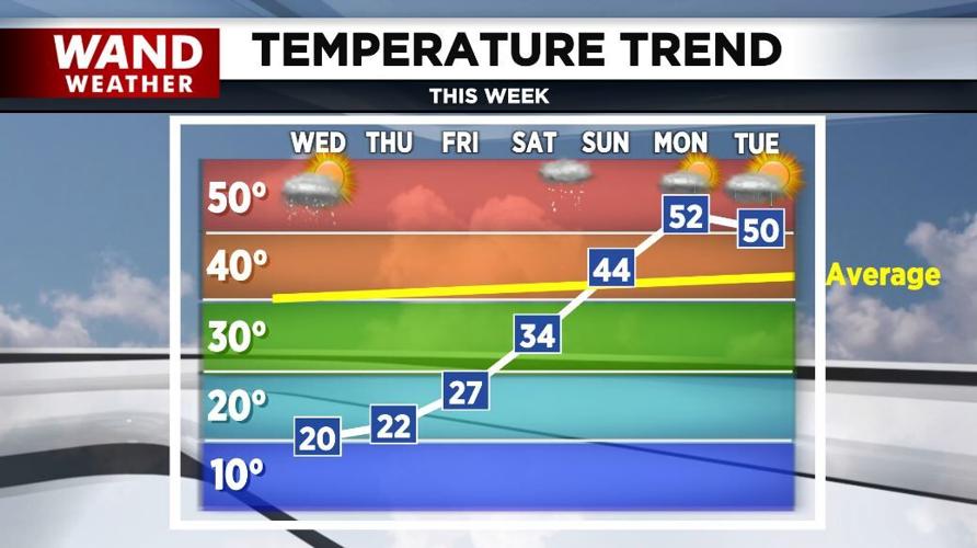
(WAND) - Three more days of very cold weather are on tap across central Illinois.
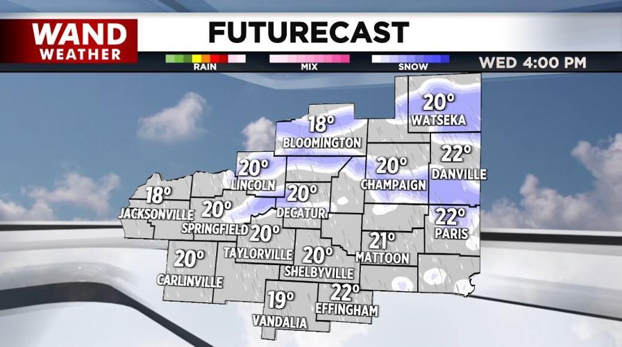
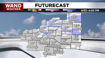
Another round of snow showers is likely this afternoon into early tonight with mostly a dusting possible. Highs today will be around 20°, but the winds will make it feel colder.
WANDWx
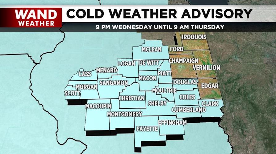
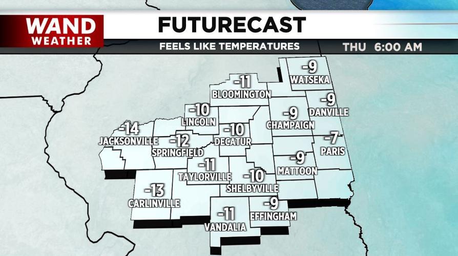
As low temperatures drop to near zero tonight, winds will make it feel -10° to -20° and a "Cold Weather Advisory" covers much of the area through 9 a.m. Thursday.

It'll become mostly sunny Thursday but remain very cold with highs in the low-20s and overnight lows in the single digits.
More sunshine is forecast Friday with highs well into the 20s.

It'll be much warmer this weekend with low-to-mid-30s Saturday and low-to-mid-40s Sunday.
By Monday and Tuesday, rain chances return with highs around 50°!

Meteorologist Anthony Peoples
Copyright 2025 WAND TV. All rights reserved.


