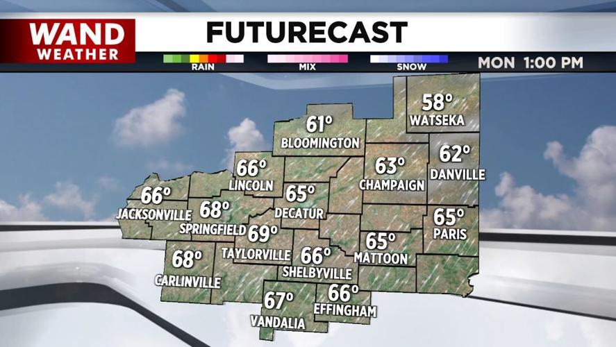


(WAND) - Record or near record highs are expected across Central Illinois Monday.
Ahead of a cold front later today, highs are going to soar into the low-to-mid-60s. Some of our record highs are in that range.
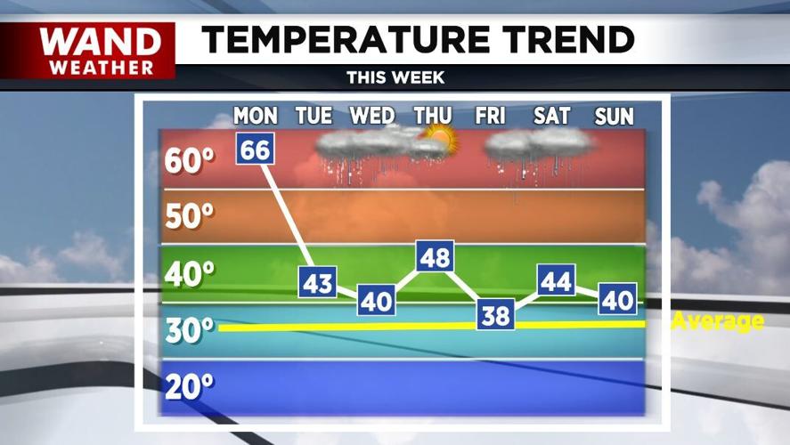
Once the front passes through tonight, it'll be breezy and much cooler Tuesday with highs about twenty degrees lower than today.

Late tomorrow night into Wednesday morning, some freezing rain is possible. As we warm to around 40° Wednesday, it should change over to all rain.
A few thunderstorms can't be ruled out Wednesday night as another cold front brings our temperatures down Thursday.
Meteorologist Anthony Peoples
Copyright 2025 WAND TV. All rights reserved.