DECATUR, Ill. (WAND) -- Heavy rain and possible severe storms are on the way to Central Illinois today, tomorrow, and into the weekend.
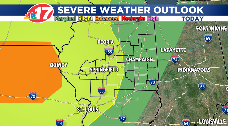
Strong storms over the Midwest will move through our area this morning into early afternoon along a warm front. As that front moves northward, it'll be very warm and muggy with highs in the mid-80s. The atmosphere will become unstable setting the stage for strong to severe storms.

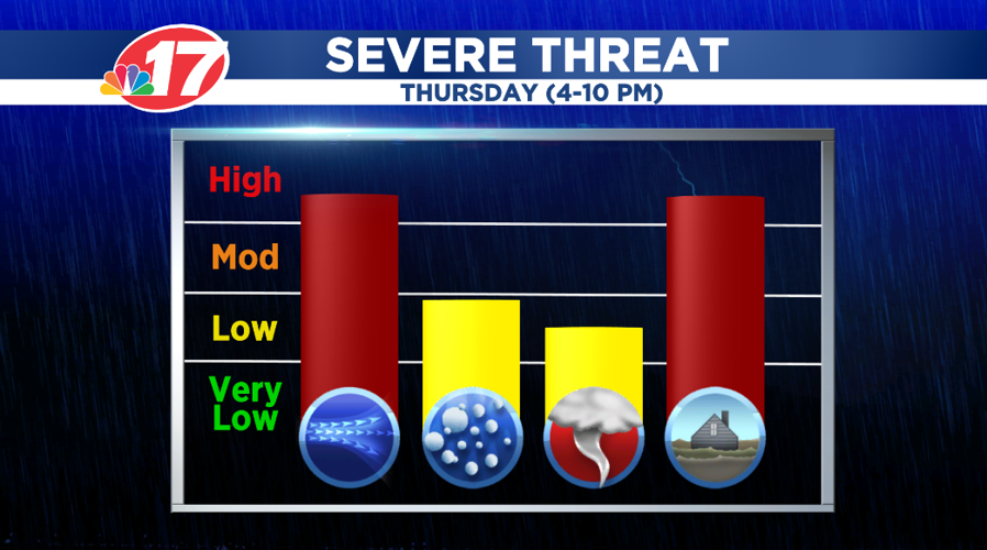
The greatest threats from these storms, between 4-10 p.m. Thursday, will be damaging winds and the potential for flash flooding. However, we can't rule out large hail and isolated tornadoes.

More severe storms are possible Friday and Saturday.
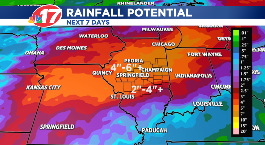
As for heavy rain, much of Central Illinois will see anywhere from 2"-6" of rain through Sunday. But, keep in mind, individual, slow-moving storms can produce that much rain alone!

The bottom line is that some hometowns will easily see more than six inches of rain through the weekend.
Make sure you keep up on the latest forecast as we go through the day and into the weekend.
Meteorologist Anthony Peoples


