
(WAND) - Severe weather is likely across Central Illinois this evening and early tonight.
It'll be a windy, hot and humid day Tuesday with highs approaching 90° and winds gusting to 40 mph.
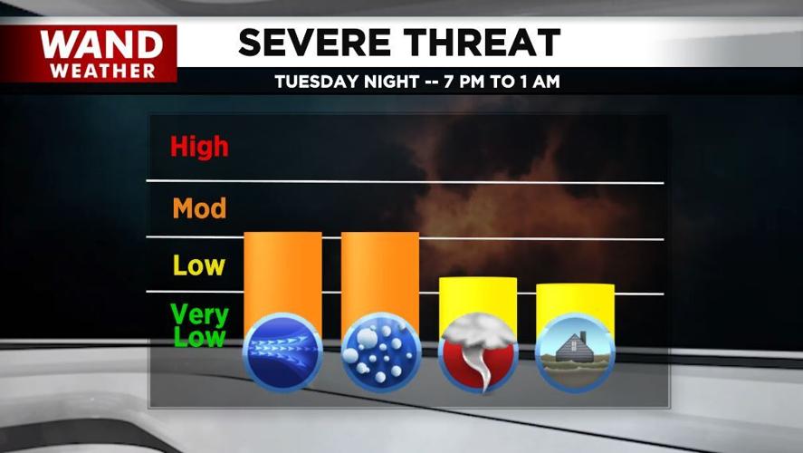
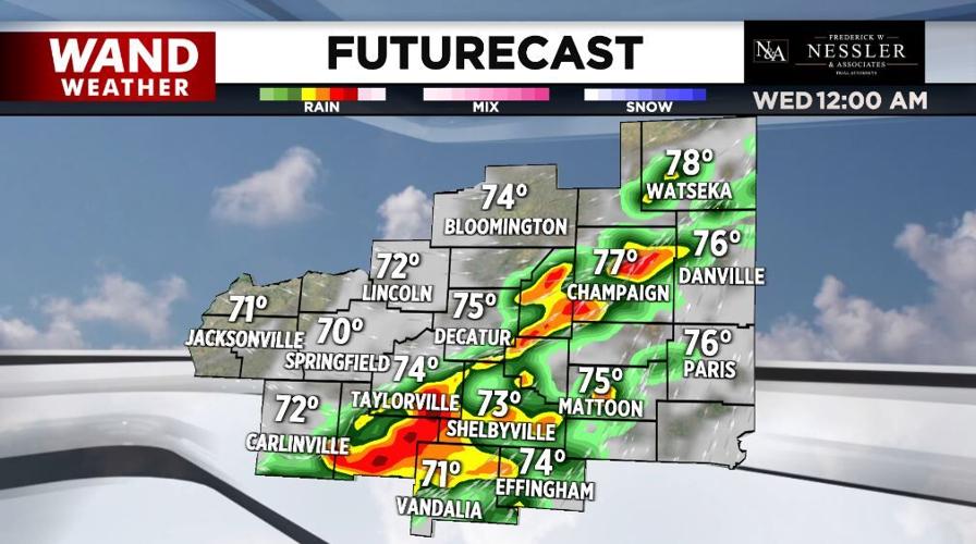
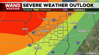
Strong to severe storms are likely this evening -- mainly from 7 p.m. to 1 a.m. Wednesday. While damaging winds and large hail are the biggest threats, tornadoes are also possible, especially west.

It won't be as warm Wednesday with highs in the upper-70s. Another round of strong to severe storms are possible later in the day across the southeast.
Thursday may be mostly a dry day with more showers and storms Friday.

As for the Memorial Day holiday weekend, scattered showers and storms are possible each day with highs in the low-to-mid-80s.
Meteorologist Anthony Peoples
Copyright 2024 WAND TV. All rights reserved.


