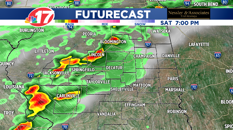
(WAND) - As we all look forward to the weekend, Stormcenter 17 Meteorologists look to Saturday evening. While Sunshine and warm weather kick starts your weekend, showers move in around 2:00 p.m. with thunderstorms closer 6:00 p.m.
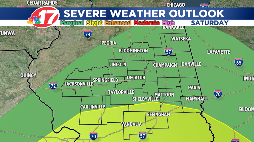
The sunshine in the morning increases instability, allowing for some of the thunderstorms to be strong to severe. The Storm Prediction Center has most of Central Illinois under a Marginal Risk (1 of 5), while Southern Central Illinois is under a Slight Risk (2 of 5) for severe weather.

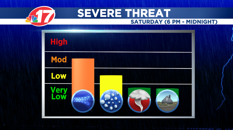
While most of the severe weather remains south of Central Illinois, latest model runs shows the ability for an isolated strong to severe thunderstorm possible near I-70. Biggest threats would be damaging winds and isolated chances of hail, although, an isolated tornado remains a very low risk (2% chance) but can't be completely ruled out.
Timing for these storms look to be from 6:00 p.m. to midnight.

Stay weather prepared by downloading the WAND Weather App for the latest information.


