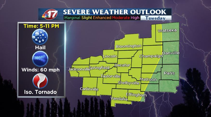


(WAND) - Strong to severe thunderstorms are possible across central Illinois Tuesday evening into early Tuesday night.
After a very warm afternoon with highs reaching the mid-to-upper-70s today, a line of thunderstorms moving along a strong cold front will drop through the area this evening.
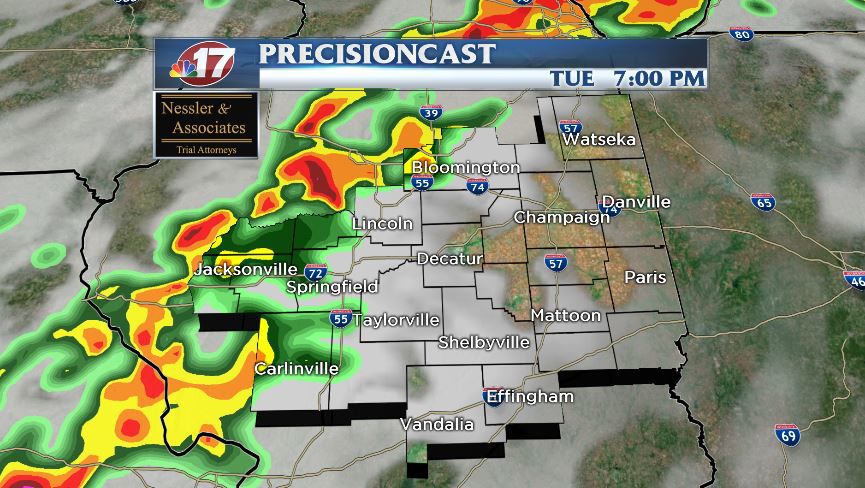
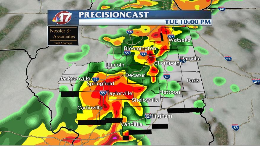
It looks like much of the severe weather will occur between between 5-11 p.m. Tuesday. Damaging winds, large hail, and heavy rain are likely and an isolated tornado or two can't be ruled out.
Once these storms move east later tonight, showers are still likely Wednesday into Wednesday night or early Thursday morning. It'll be much cooler Wednesday with highs only in the 50s.
Rainfall amounts will generally be in the one-half inch to two inch range, but there could be some isolated higher totals with the stronger storms.


