


(WAND WEATHER) - It's the last weekend of winter and it's definitely going to feel like it across Central Illinois.
Ahead of a strong cold front Thursday, we saw rain and temperatures in the 50s.
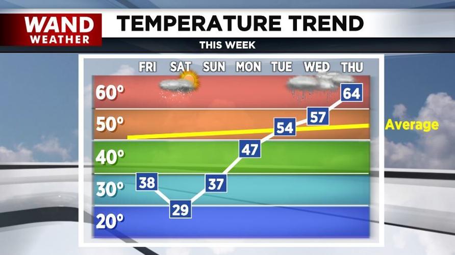
Today, clouds will give way to sunshine, brisk winds, and afternoon readings in the 30s to near 40°.
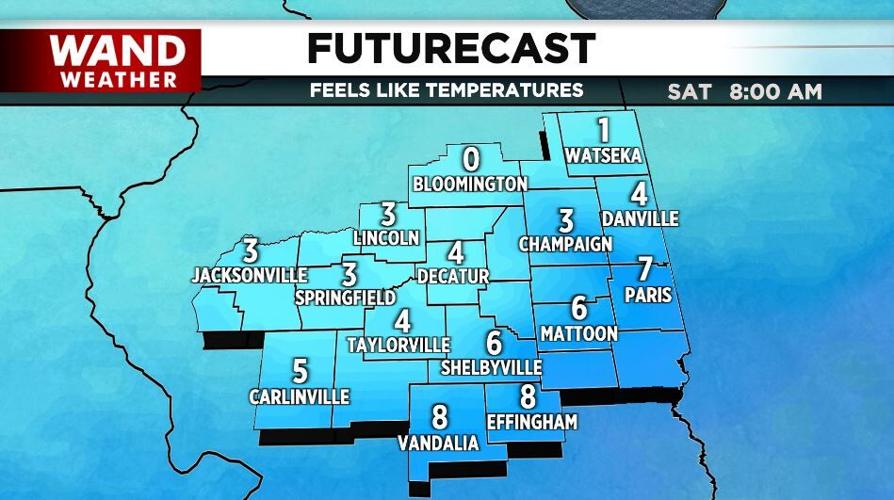
It'll be very cold tonight and Saturday night with lows in the teens to near 20°, but winds chills will drop into the single digits. Highs Saturday will be below freezing and snow flurries are possible.
A warming trend begins Sunday. With plenty of sunshine, highs will reach the upper-30s.
We'll be in the 40s Monday and in the 50s Tuesday and Wednesday.
Rain returns Tuesday night through Thursday.
Meteorologist Anthony Peoples
Copyright 2023 WAND TV. All rights reserved.


