
• CLICK HERE FOR THE MOST UP-TO-DATE FORECAST INFORMATION.
The following story is from Friday morning's forecast. Click above for the most recent forecast information from the WAND Weather Team.
(WAND) - Friday and Saturday set the tone for the winter storm that arrives across central Illinois with sub-freezing temperatures.

Skies for Friday night will be mostly clear and in the low 10s; while clouds begin to gradually increase on Saturday, with highs in the mid 20s.
Click here to find a list of warming centers across Illinois.
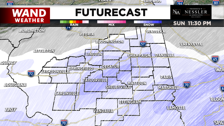
The snow is forecasted to arrive during the overnight hours on Sunday over our southwestern communities. This will spread across the region on Sunday, with the heaviest snowfall happening during the afternoon & nighttime hours. The snow will gradually taper off throughout the day on Monday. Southern areas especially towards I-70 could see sleet during the afternoon & evening on Sunday with highs in the mid 20s.

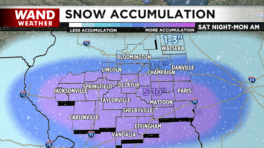
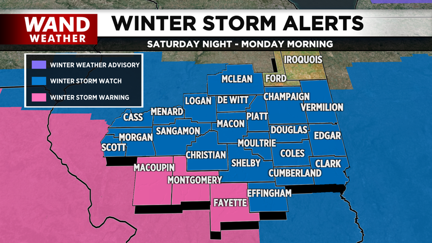
Most of central Illinois is currently under a Winter Storm Watch; while a Winter Storm Warning is in effect for Macoupin, Montgomery & Fayette Counties from Saturday night to Monday morning. Snowfall amounts will be heaviest points south of Lincoln & Champaign with 5-10 inches; however southern areas could see lesser amounts depending on the sleet or freezing rain. Areas just north of Champaign & Lincoln will be 3-5 inches; while spots north of Bloomington plus Ford & Iroquois Counties at 1-3 inches. Also, the storm will produce blustery to windy conditions at times; producing sustained winds up to 25 mph & gusts over 30 mph, which will produce near zero visibility.

Temperatures will turn even colder once the system exits Central Illinois; as highs will be in the teens during the midweek, while lows will fall to either side of zero. This will produce feels-like temperatures across the area to be subzero, as early as Monday night.
Stay tuned throughout the weekend for more updates on this winter storm.
Meteorologist Ulises Garcia
CLICK HERE FOR THE MOST UP-TO-DATE FORECAST INFORMATION.
The following story is from Friday afternoon's forecast. Click above for the most recent forecast information from the WAND Weather Team.
Copyright 2025 WAND TV. All rights reserved.


