• CLICK HERE FOR THE MOST UP-TO-DATE FORECAST INFORMATION.
The following story is from Friday morning's forecast. Click above for the most recent forecast information from the WAND Weather Team.
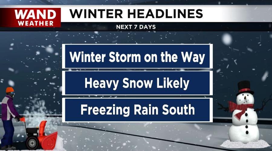
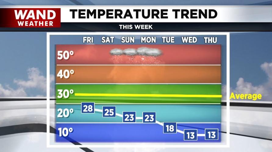
(WAND) - The first major winter storm of the season is on the way to Central Illinois. Today and tomorrow will be rather quiet under a sun and cloud mix. Highs will be in the 20s today and tomorrow with lows tonight of 10°-15°.
Click here to find a list of warming centers across Illinois.

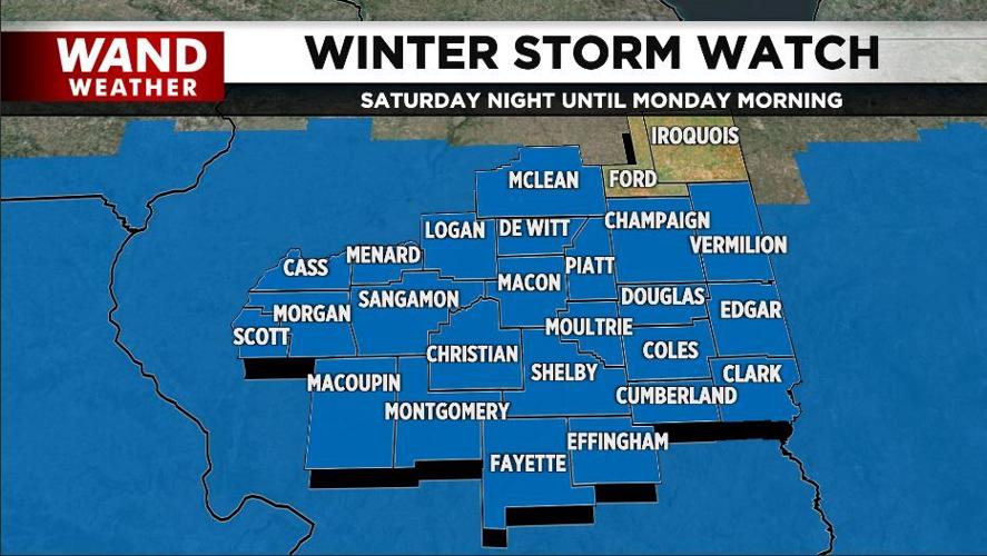
A "Winter Storm Watch" goes into effect for most of Central Illinois Saturday night through Monday.
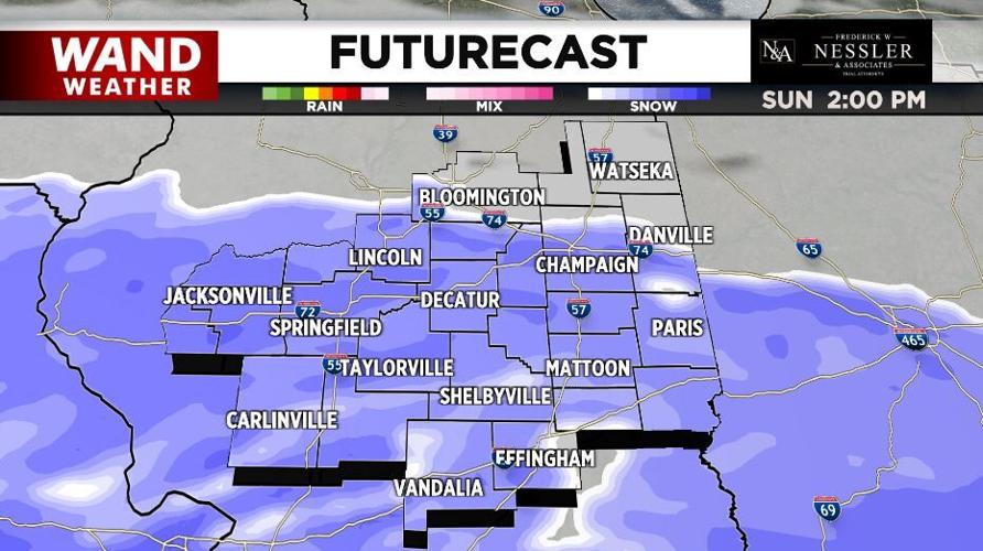
Snow moves in Saturday night and it'll become rather heavy at times Sunday and Sunday night.

Blustery winds will also produce blowing and drifting snow.
At this point, it looks like most of the area will see 6-10" of snow. Across the far northern hometowns, those totals will be on the lower side.


Bitterly cold air blows in next week and sticks around through the middle of January.
Copyright 2025 WAND TV. All rights reserved.


