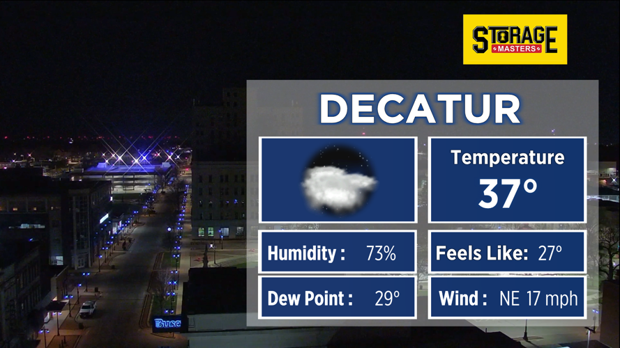
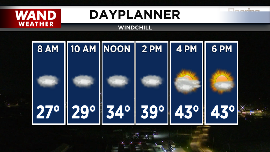


DECATUR, IL. (WAND) - Happy Tuesday! Temperatures have dropped overnight as the rain has moved in from the west. The coldest temperatures are east of Macon County, and that’s where the freeze warning is in place until 9 am this morning. Light rain is moving through areas west of I-55 and south of I-72. This is the area we are watching to see if the rain will transition to snow.
Some light accumulation will be possible on the grass and raised surfaces. Precipitation will move out of the area through the morning, and dry conditions will take over for the afternoon. Temperatures will warm up into the 40s by the afternoon, and clouds will start to clear out through the evening.
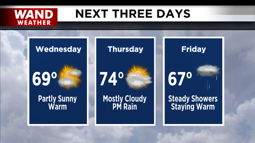
Cooler temperatures in the 30s return overnight into Wednesday morning. It will be a breezy day with winds out of the south. This will usher in a major warming trend for Wednesday afternoon. High temperatures will top off near 70 degrees by Wednesday evening. Warm temperatures will linger through the end of the week.
Rain chances return overnight Thursday into Friday morning. Steady showers are expected on Friday. Temperatures will soar into the upper 70s and low 80s by the weekend.
Copyright 2026. WANDTV. All Rights Reserved.


