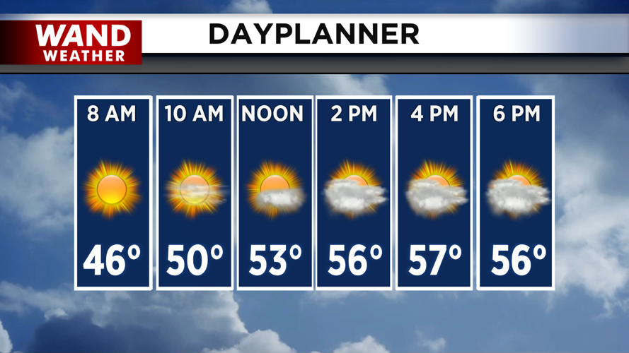


DECATUR, IL. (WAND) - Happy Friday! It will be a very similar day to Thursday. Expect plenty of sunshine for the first half of the day. Clouds will build into the region through the afternoon. Overcast skies with winds out of the northwest will make it feel cooler than yesterday, with highs staying in the upper 50s.
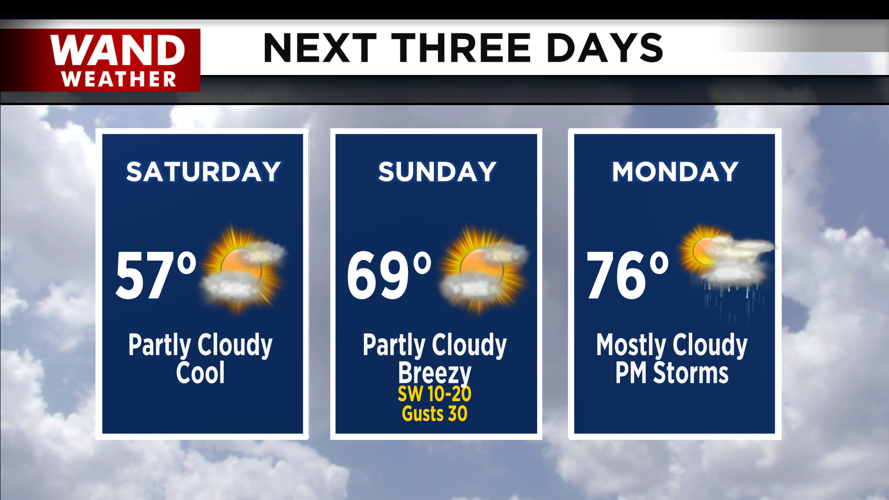
The frost threat will be much lower tonight for areas along and south of I-72 due to clouds hanging around overnight into Saturday morning. Areas north of I-74 will have clear skies and could have a higher threat for some frost. Temperatures will be slow to warm up on Saturday with highs in the upper 50s.
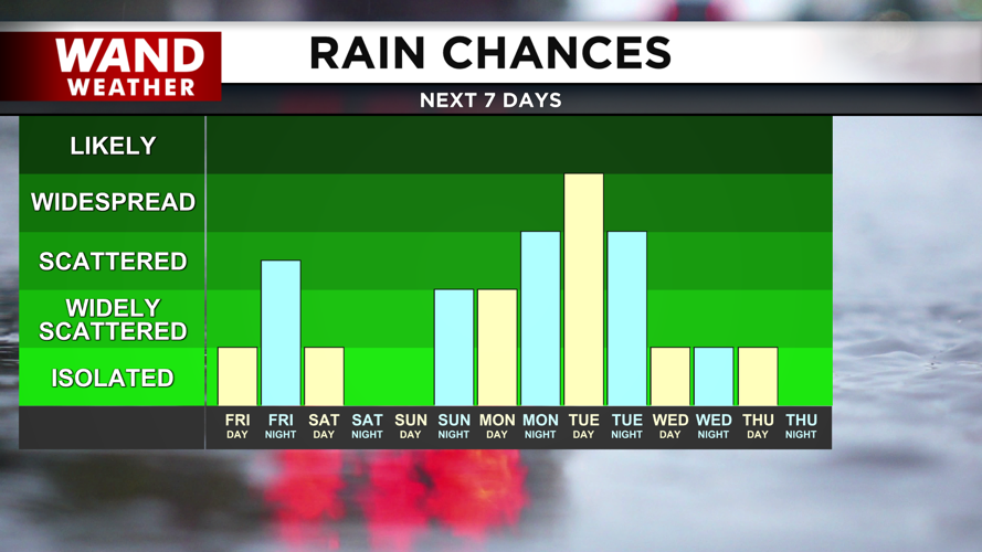
Temperatures will be much warmer on Sunday. High temperatures will climb into the upper 60s by the afternoon. Winds will pick up with gusts around 25 to 30 mph. Rain and storm chances will move in overnight into Monday.
Next week will start warmer in the 70s, but rain and scattered storm chances will ramp up through Tuesday. Temperatures will trend cooler for the end of next week. Have a great weekend!
Copyright 2026. WANDTV. All Rights Reserved.


