
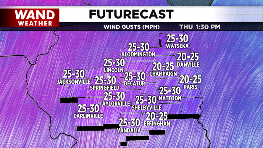


DECATUR, IL. (WAND) - Happy Thursday! We have another warm and sunny day on tap for Thursday. This will be the hottest day of the week with highs hitting the low 80s this afternoon. Strong winds out of the south will pick up through the day with gusts around 30 mph.
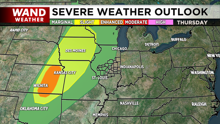
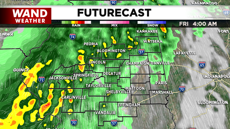
Temperatures will stay mild overnight in the 60s ahead of storms moving into the region. Strong thunderstorms will move in after midnight. Storms will be scattered with better chances of severe storms further west. The severe weather risk will be low tonight for Central Illinois. The I-55 corridor could see some damaging wind gusts, but areas east of that will see general thunderstorms.
A few scattered storms could hang around for the afternoon, but most of the area will dry out with a mix of sun and clouds. It is a fantastic-looking weekend ahead. High temperatures will be in the low 70s for Saturday and Sunday with plenty of sunshine. Overnight storms will move in Sunday night, and could lead to some severe weather chances next Monday.
Copyright 2026. WANDTV. All Rights Reserved.


