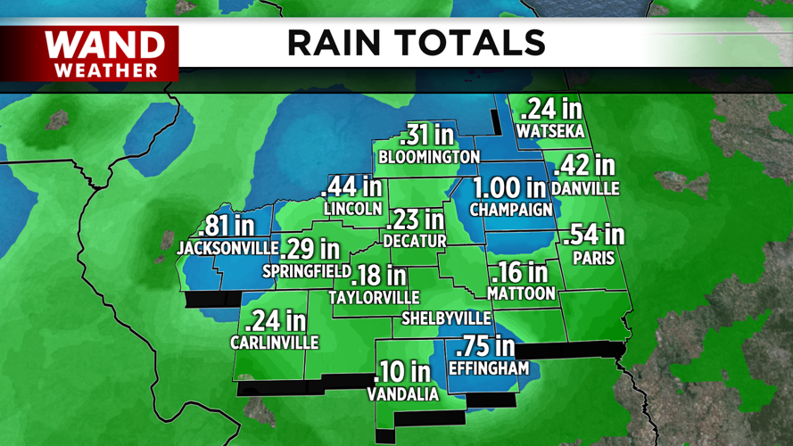


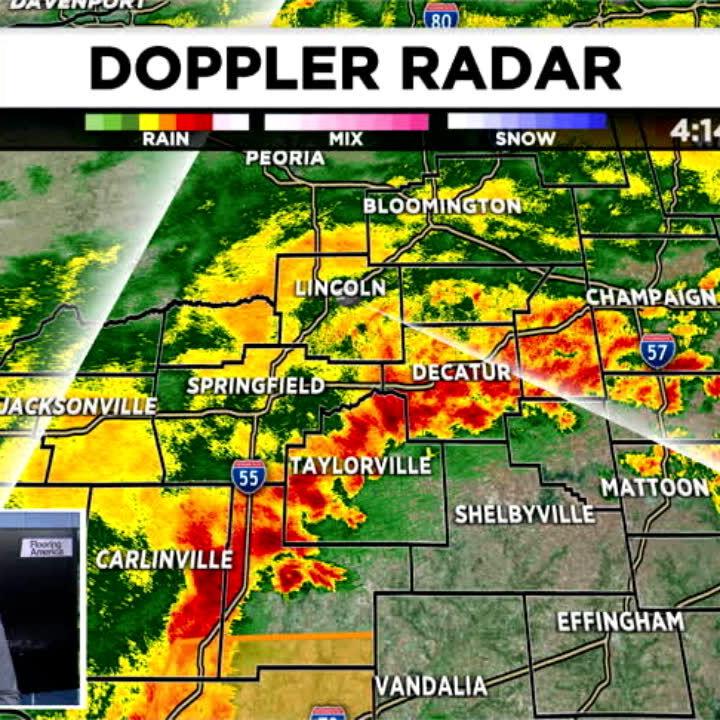
DECATUR, IL. (WAND) - Happy Friday! The severe weather threat is over for now, but it will be a windy start to our Friday. Rain totals from yesterday varied greatly, with places like Champaign getting an inch of rain, while places like Decatur saw less than a quarter inch. This was due to the stronger thunderstorms across the region. Several tornado warnings were issued yesterday evening before the storms moved outside of Illinois.

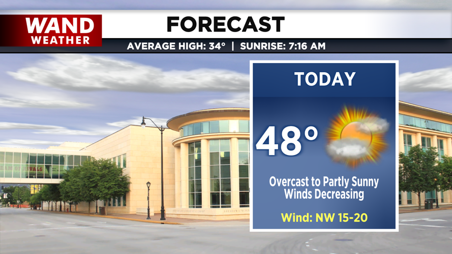
Temperatures today are starting mild, but they will be cooling throughout the day as cold air moves in. Expect afternoon temperatures to be in the upper 40s. Clouds will clear throughout the day, and wind gusts will drop as well.
Rain chances return tonight as our next system moves through Illinois. There could be a light wintry mix with this system, but most of the area should see light rain as temperatures remain above freezing. Saturday will be cooler with highs staying in the low 40s.
Much colder air moves in for the back half of the weekend. Temperatures will be in the low 20s for Sunday morning and only warm up into the low to mid-30s by the afternoon. That puts Sunday’s conditions very close to average for early January.
Have a great weekend, and stay warm!
Copyright 2026. WANDTV. All Rights Reserved.


