


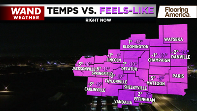
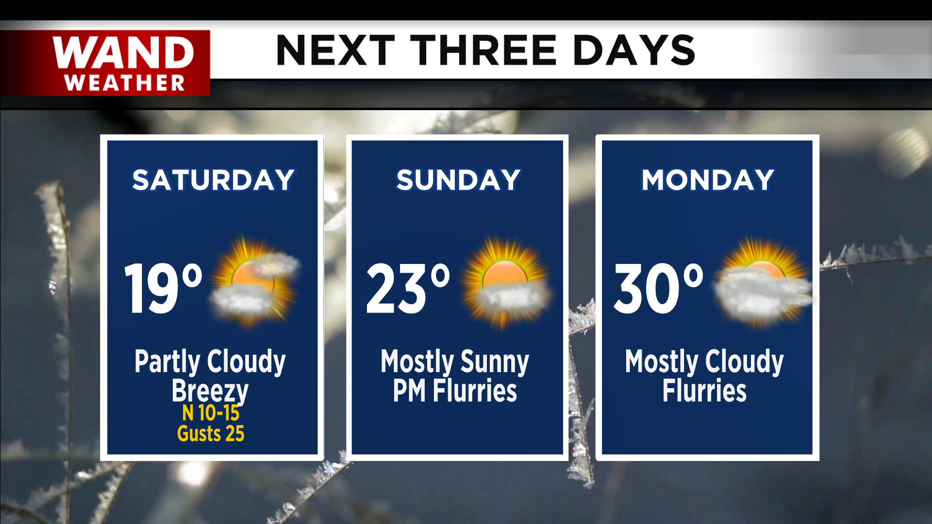
DECATUR, IL. (WAND) - Happy Friday! Temperatures have once again plummeted overnight. Temperatures will be in the low single digits with wind chills well below 0 in the negative teens to start the day. Sunny skies early will give way to mostly cloudy skies for the afternoon. High temperatures this afternoon will warm up into the teens, but wind chills will stay close to 0.
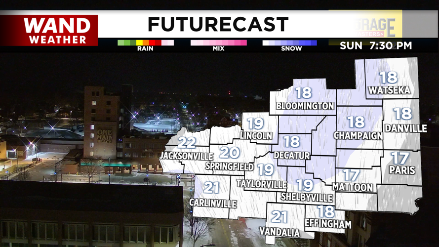
A chance of flurries will move in this evening with some light lake effect snow. Snow won’t stick for most of Central Illinois, but we could see a few flakes. Areas north of I-74 could see a light dusting. Temperatures will again drop into the single digits tonight as winds pick up out of the north.

Temperatures will stay cold this weekend, with highs in the teens and low 20s. Mostly sunny skies will hang around for Sunday, with some snow chances moving in overnight into early Monday morning. Snow totals look low with this system, but a light dusting to a coating of snow is possible for early Monday morning.
Next week looks a bit warmer, with highs climbing back into the low 30s. This is still below average for early February. Snow chances will return for the middle of next week.
Have a great weekend and stay warm!
Copyright 2026. WANDTV. All Rights Reserved.


