

DECATUR, IL. (WAND) - Monday will bring a dangerous combination of extreme heat and a significant severe weather threat to Central Illinois, making it an impactful day for the region.
The Morning: Fog and Scattered Storms
The day starts with patchy to dense fog, particularly along and east of I-57, which could reduce visibility during the morning commute. Scattered storms are possible early in the day, but most of the region should remain dry through mid-morning.
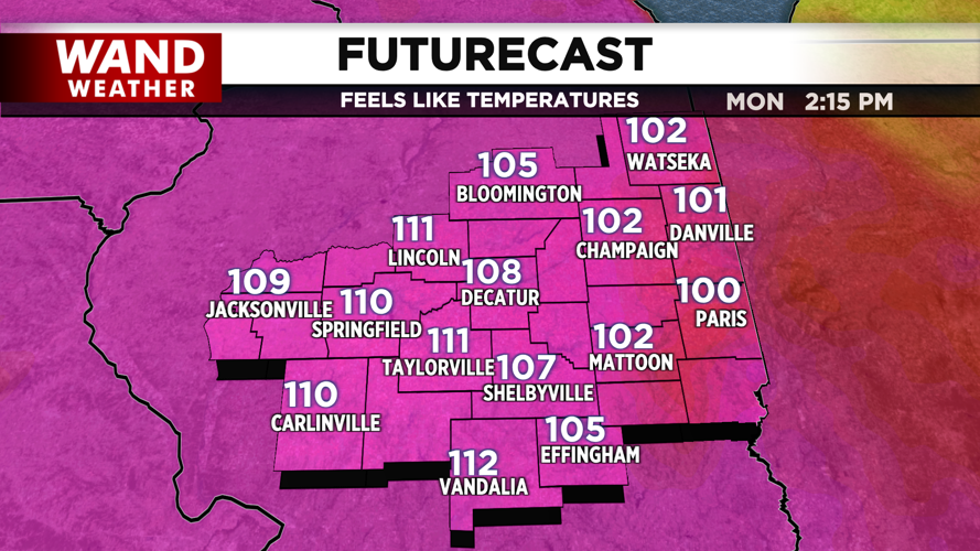
Midday: Dangerously Hot
An Extreme Heat Warning remains in effect until 9 p.m. tonight as temperatures climb into the mid-90s with mostly sunny skies. The real concern is the heat index — values are expected to push into the dangerous 110-degree range. Southwesterly winds of 10 to 20 mph will do little to provide relief. This is dangerous heat. If you're working or spending time outside, take frequent breaks in air conditioning, drink plenty of water, and watch for signs of heat exhaustion.
Afternoon and Evening: Severe Weather Threat
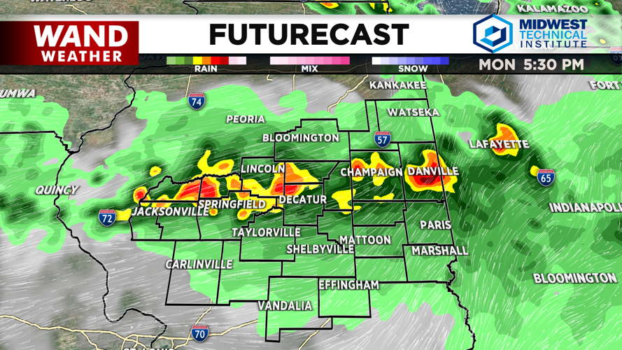
A complex of storms is expected to develop north of the region this afternoon and evening, moving southward at a quick pace. This is where the day becomes particularly dangerous.
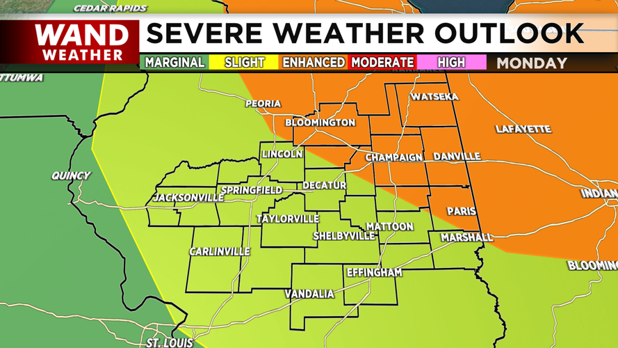
The Storm Prediction Center has placed northern and eastern counties in an Enhanced Risk for severe weather. The primary threat is damaging winds — there's a 15-30% risk of damaging gusts, with a Level 1 risk for winds exceeding 75 mph across much of Central Illinois. Large hail is also possible, particularly in the northeastern part of the region, with a 5-15% risk. A tornado risk of 2-5% exists, though it remains relatively low.
Storms should clear by early evening, with calmer conditions returning by 10 p.m.
Tonight and Beyond
Overnight lows will remain warm in the 70s as a cold front approaches. Tuesday will bring relief, with highs in the mid to upper 80s before shifting to the low to mid 80s for the rest of the week. Humidity will drop significantly, and mostly sunny conditions should continue through Friday.
Copyright 2026. WANDTV. All Rights Reserved.


