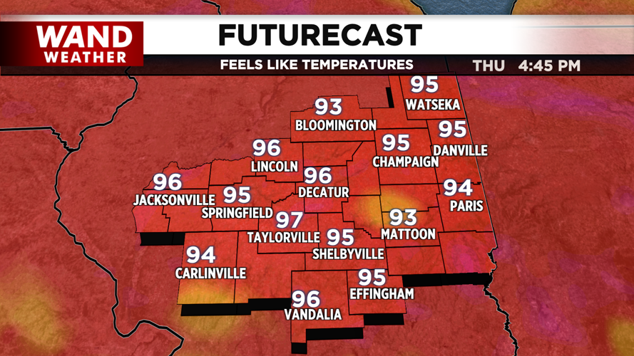


DECATUR, IL. (WAND) - Central Illinois will remain hot and humid through Saturday, with afternoon heat index values climbing to around 100 degrees — and possibly higher as we approach the weekend.
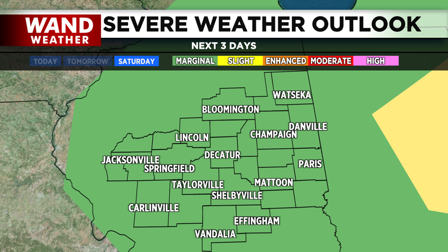
Showers and thunderstorms will be possible from this afternoon through Saturday evening, with the best chances in southeast Illinois. While most storms should be isolated to scattered, there is a marginal risk of severe weather Saturday afternoon into the evening, mainly for damaging winds. Southeast Illinois also faces a marginal risk of excessive rainfall this afternoon, with eastern Illinois at risk Friday afternoon.
A weakening cold front will move through Central Illinois this morning but is expected to retreat this afternoon. This could trigger some isolated to scattered showers and thunderstorm activity, particularly in southeast Illinois, where tropical moisture is moving in from the south.
Highs today will reach the upper 80s to lower 90s, but with dewpoints in the low to mid 70s, afternoon heat indices will feel closer to the upper 90s to lower 100s. A few storms in southeast Illinois could produce gusty winds and possible funnel clouds into early evening.
Overnight, expect muggy conditions with lows dropping only to the lower 70s. Thin elevated smoke may be visible at high altitudes, with more prominent smoke the further north you go.
Friday: More Tropical Moisture, Afternoon Storm Chances
Deeper tropical moisture will push further north into Central Illinois on Friday, increasing the chance for isolated to scattered showers and thunderstorms, especially during the afternoon. The best chances will be east of the Illinois River.
Highs on Friday will be in the upper 80s to near 90 degrees, with afternoon heat indices in the upper 90s to near 100 degrees. Eastern Illinois faces a marginal risk of excessive rainfall Friday afternoon, though most areas will see only a tenth to a quarter of an inch of rain.
Saturday: The Hottest Day, Strongest Storm Threat
Saturday will be the hottest day of this stretch, with highs in the lower 90s and afternoon heat indices reaching 100-105 degrees — approaching heat advisory criteria by Saturday afternoon.
A stronger cold front will move into the region late Saturday afternoon and evening, bringing another round of showers and thunderstorms. Storm chances will increase significantly during the mid to late afternoon into the evening, with the highest rain chances in eastern Illinois as the front approaches.
The marginal risk of severe weather Saturday afternoon into the evening is mainly for damaging winds, though locally heavy rainfall is also possible with atmospheric moisture levels near 2 inches.
Looking Ahead: Relief Coming
After Saturday, temperatures are expected to trend below normal for July 21-25, which should bring some relief from this hot and humid pattern. Precipitation should remain near normal through the end of July.
Copyright 2026. WANDTV. All Rights Reserved.


