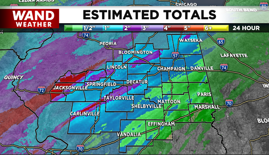


(WAND) - Heavy rain with embedded thunderstorms moved through parts of central Illinois today and will continue this evening. Overall this is the most rain we'll likely see over the next week as a downward trend in coverage and intensity is expected before daybreak tomorrow. Nonetheless, doppler estimates are over 2 and 3" in some areas and there are additional bouts of wet weather right on through this weekend.
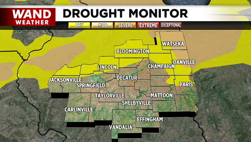
Unfortunately, today's rain tally will not be shown on this Thursday's drought monitor, as the data for this week has already been compiled.
Stay safe and weather aware with the WAND weather app. It's a free download for your smart phone that can be invaluable, especially with NOAA weather radio down until Friday.


