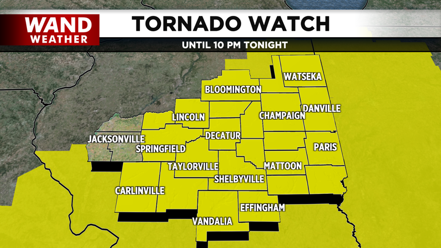


DECATUR, Ill. (WAND) - The National Weather Service Storm Prediction Center has expanded a Tornado Watch for central Illinois on Wednesday.
The watch is in effect until 10 a.m. CDT for most of the WAND viewing area.
A strong line of storms is moving through the state Wednesday afternoon. The WAND Weather Team is forecasting the possibility of 80 mph wind gusts, hail up to 1.5 inches (ping pong ball) in diameter and a few tornadoes with isolated intense tornadoes.
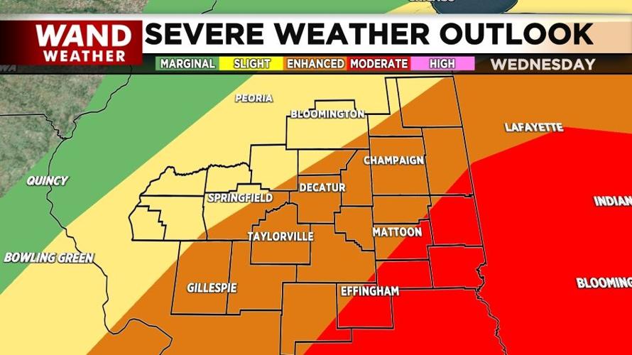
The Storm Prediction Center has continued the Moderate (Level 4) risk for southeastern WAND communities, while the Enhanced risk has reduced from Carlinville to Wateska and points east. Western WAND communities are now placed within a Level 2 (Slight) risk.
Another element that will be a factor besides the storms is the winds. As of 10 a.m., a Wind Advisory is in effect until midnight Thursday. Expect southerly winds up to 30 mph with gusts up to 50 mph throughout the day and Wednesday evening.
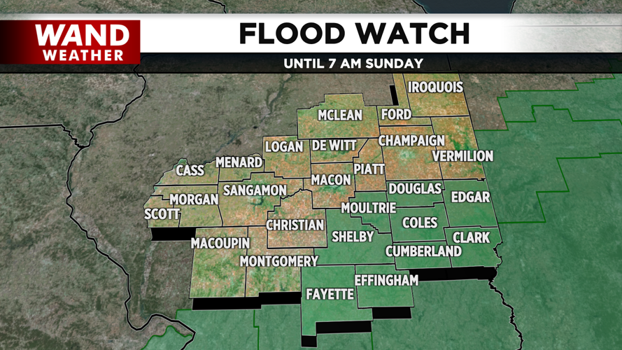
A Flood Watch is in effect for the southeastern portion of central Illinois from Wednesday afternoon through Sunday morning. Wednesday's cold front will stall out south of our away starting Thursday, which will bring multiple rounds of rain through the weekend. Multiple inches of rain are forecasted with flooding being a greater concern towards the southeast.
Stay tuned with WAND for more updates on the forecast. Also, download our free WAND Weather app to track the storms and get weather alerts wherever you are located.
Copyright 2025. WAND TV. All rights reserved.


