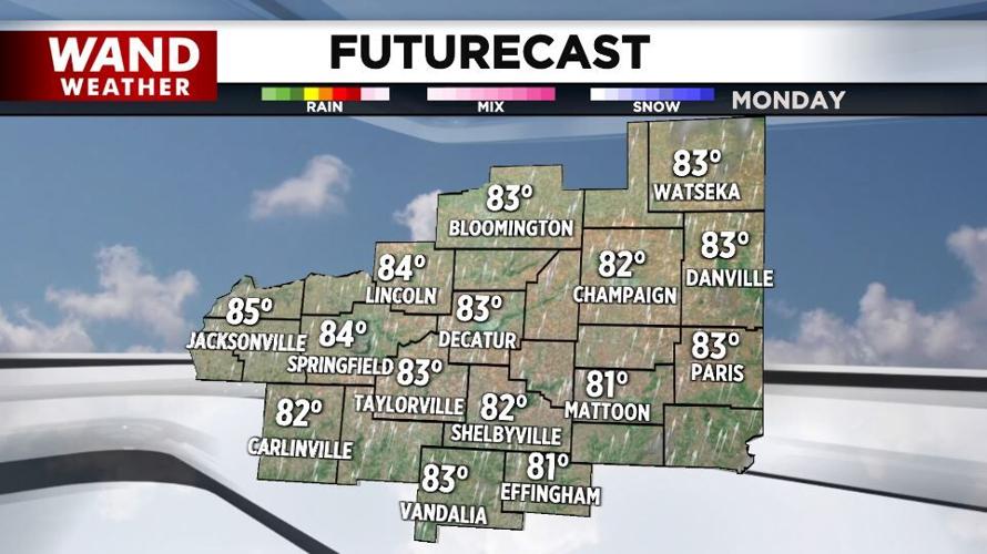

(WAND) - The new week will feature several chances of showers and thunderstorms.
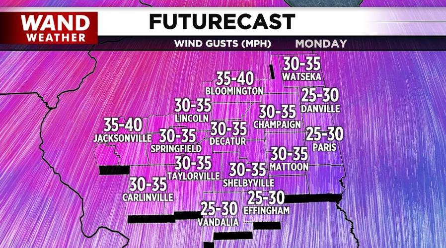
It'll kick off today with very windy and warm conditions with highs in the low-to-mid-80s and southerly wind gusts to 40 mph.
Those winds combined with plowing from the start of the growing season may produce blowing dust since the top layer of soil is rather dry.

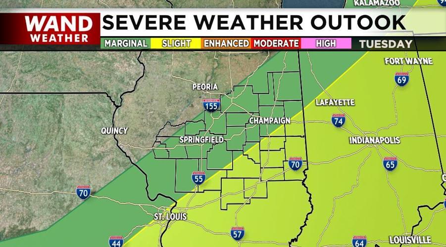
Severe storms moving out of the Midwest tonight will bring the threat of severe weather to Central Illinois around daybreak Tuesday through midday. Damaging winds and large hail will be the biggest threats.

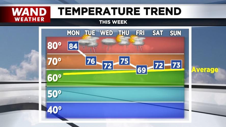
Another moderate rain event is expected later Wednesday into Friday.
After today's 80s, highs will be in the 70s Tuesday through Thursday and around 70° late week.

Meteorologist Anthony Peoples
Copyright 2025. WAND TV. All rights reserved.


