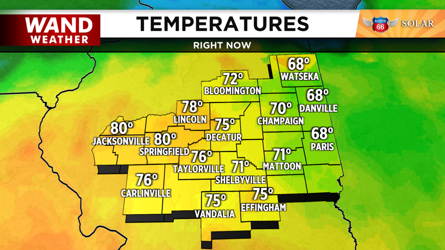


DECATUR, IL. (WAND) - The severe weather risk for Tuesday evening is starting to come into focus. Temperatures have soared well into the 70s and even some 80s early Tuesday afternoon.
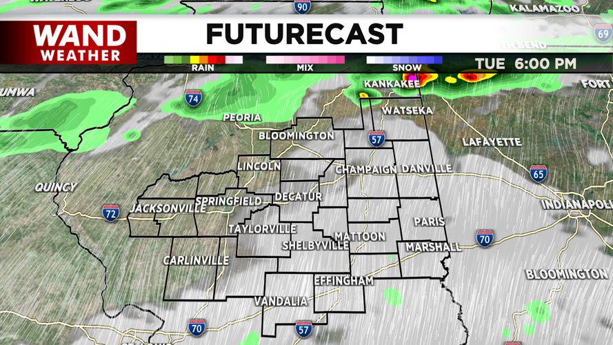
As a warm front lifts across the region, there could be quickly developing strong to severe storms. That timeline would be from about 2-4 pm, and mainly for areas north of I-72. These would be very isolated, but could produce damaging hail and tornadoes.

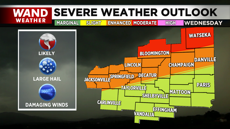
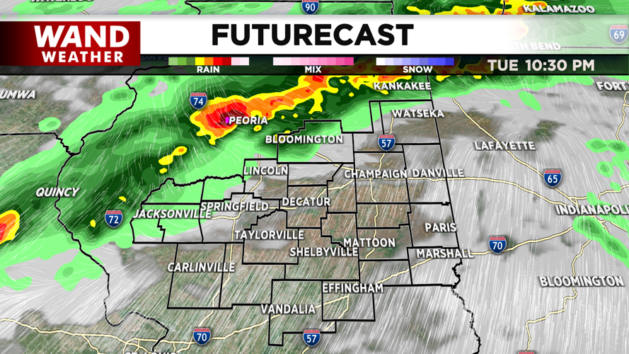
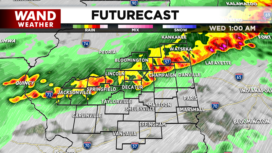
The main threat of severe storms will move in later Tuesday evening. The Storm Prediction Center has issued a Moderate (level 4 out of 5) threat for severe storms to develop. This is for areas north of I-74 and includes McLean, Ford, and Iroquois counties in the WAND viewing area. This area will need to be watched closely, as a level 4 risk is a strong indicator that tornadic activity is likely.
DOWNLOAD THE WAND WEATHER APP | Get weather information no matter your location.

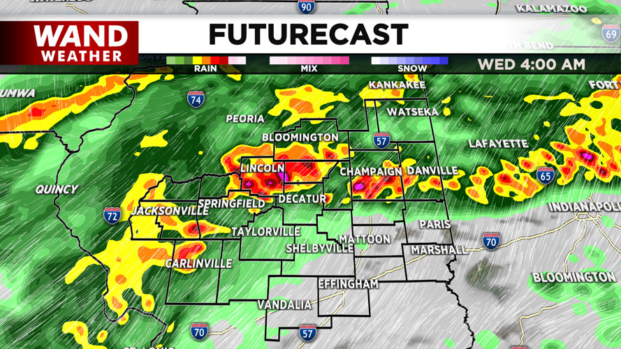
Most of the I-72 corridor is under an enhanced (level 3 out of 5) threat for severe storms. While it is a lower risk level, this is still an indication that strong storms will move through the area. These storms will impact the region from 11 pm to 3 am Wednesday.

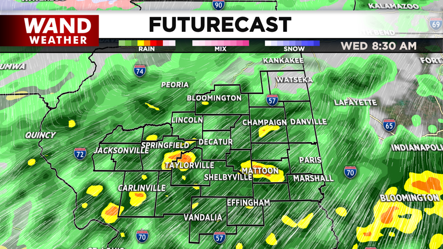
Areas south of I-72 will be at a slight (level 2 out of 5) threat for severe storms. These storms will push through Central Illinois early Wednesday morning from 3 to 7 am. Strong winds and some hail will be the biggest threat.


The bottom line with these storms is to be weather aware through the overnight hours. Have your phone charged and close enough to hear tornado warning alerts. Have a flashlight and batteries close by. Download the WAND weather app to get alerts sent directly to your phone.

Stay safe!
Copyright 2026. WANDTV. All Rights Reserved.


