


DECATUR, IL. (WAND) - Happy Sunday! Today will be the day to be weather aware as we get ready for showers and a few thunderstorms to return to Central Illinois.
We start the day with a few rain showers rolling through to the northwest. Portions of Mclean county may start the day with a period of heavy rain and rumbles of thunder through the late morning. Temperatures today warm to the mid 60s as the warm front bringing the initial round of rain passes through.

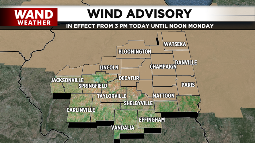
The cold front arrives by the mid afternoon and may bring a line of thunderstorms between 2pm and 6pm. These will likely bring damaging gusty winds, small hail, and even the risk of an isolated spin up tornado. A Wind Advisory will go into effect this afternoon at 3pm, and continue through tomorrow morning. You’ll want to stay weather aware with the potential for severe weather during this time.

We’ll be back to dry and quiet conditions by late tonight, but we plunge into much colder temperatures in the teens overnight into tomorrow morning. With wind gusts up to 50 mph even into our early Monday, we’ll likely feel more like single digits and below 0 degrees on the way into work. Watch for icy spots on untreated roads and sidewalks.
Copyright 2025. WANDTV. All Rights Reserved.


