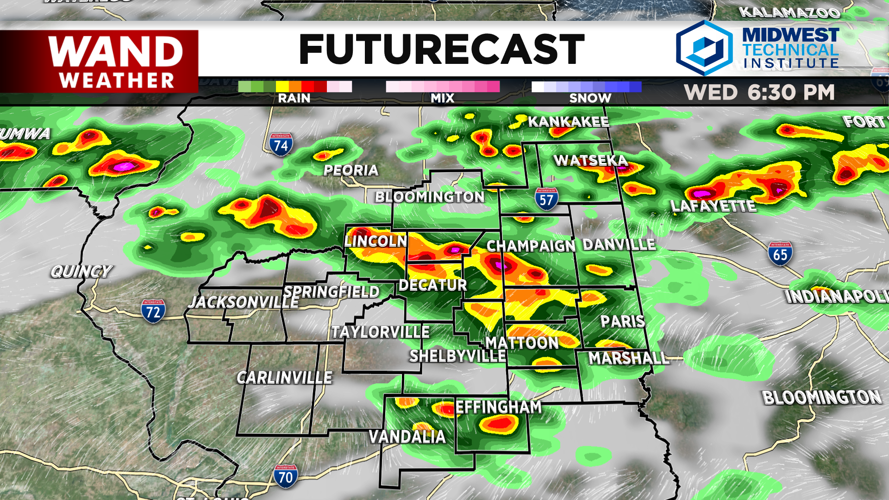


DECATUR, IL. (WAND) - Central Illinois will see a more active weather day Wednesday, with periods of showers and thunderstorms expected to impact the region in two rounds — this morning and again later this afternoon into the overnight hours.
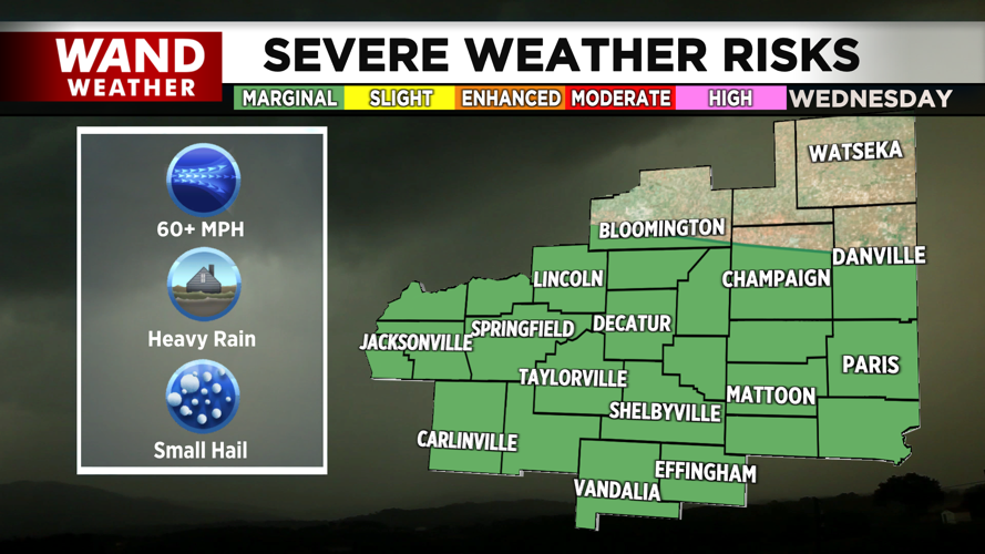
The primary concern is the potential for damaging winds, heavy rain, and localized flooding. A Flood Watch has been issued for the northern half of Central Illinois from noon to midnight Wednesday. Areas along and south of Interstate 72 are under a marginal risk for severe storms, according to the Storm Prediction Center.
Rainfall amounts of 1.7 to 2.0 inches are possible across the region. While moisture levels won't be quite as high as last week, atmospheric conditions are still favorable for strong storm development.
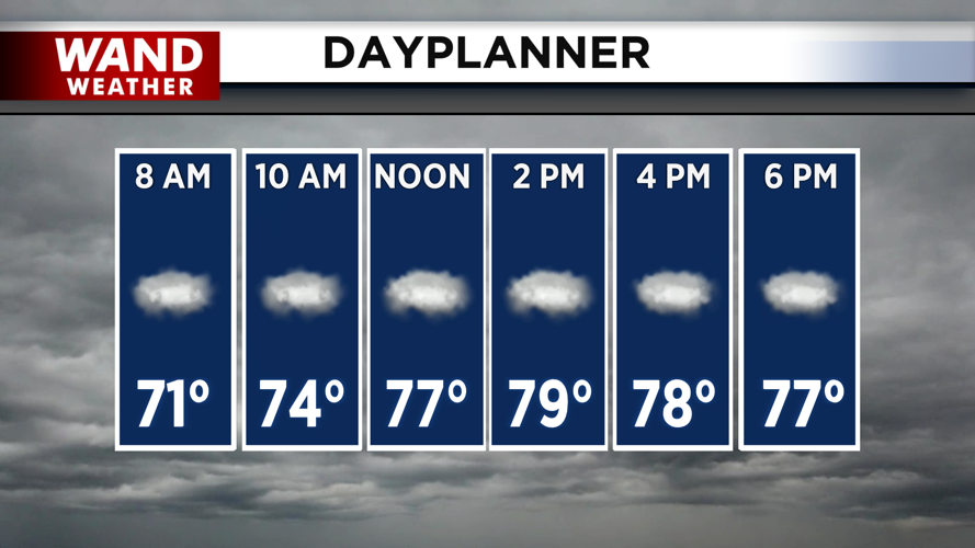
Afternoon temperatures will reach the upper 70s before storms move in. Strong thunderstorms will persist through the early morning hours Thursday before exiting the area completely.
Thursday brings much-needed relief. Conditions will turn calmer and drier with northwest winds ushering in pleasant weather. Highs will reach around 80 degrees with mostly sunny skies.
Friday will be slightly warmer with highs in the low 80s and a mix of sun and clouds. Scattered storms are possible overnight Friday into early Saturday morning, but they should clear out before sunrise.
Looking ahead to next week, expect dry and mild conditions to settle in. Pleasant August weather will continue with highs in the upper 70s to low 80s and overnight lows in the 60s.
Copyright 2026. WANDTV. All Rights Reserved.