

DECATUR, IL. (WAND) - Happy Fri-yay! We’ve made it to the weekend, and we close out on a sunny note.
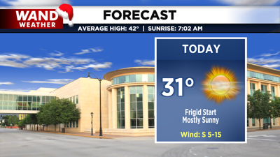
Frigid temperatures continue this morning, most of us will see wind chill values dip between 5 and -10 degrees through the mid morning. Southerly flow and sunshine will help to bring us into the low 30s by the afternoon. Clouds return late tonight and into tomorrow ahead of our next weather maker.

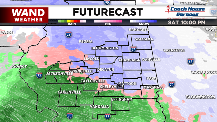
A train of clipper systems will pass through the Great Lakes region next week. The first will bring slippery travel conditions starting late tomorrow night as a mix of rain and snow rolls through.

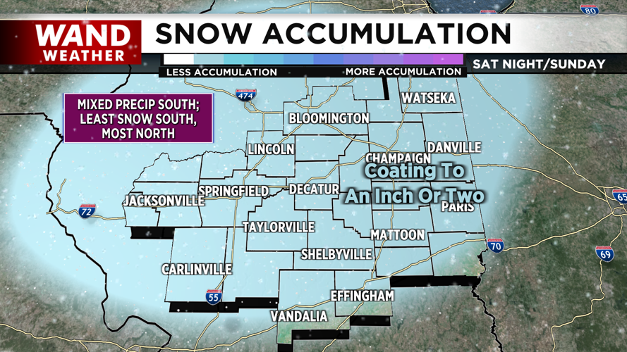
We may see a coating to an inch of snow accumulated with a few hometowns farther north seeing up to 2 inches. The rain/snow line will dip south along I -70 late Saturday, and peak north heading into Sunday before the mixed precip tapers off in the afternoon. This will limit accumulations for areas farther south.
Copyright 2025. WANDTV. All Rights Reserved.


