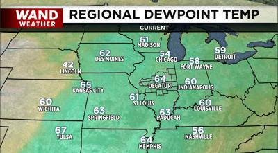

DECATUR, Ill. (WAND) - Higher humidity is the name of the game. More times than not when it's this warm and humid this time of year, there are thunderstorms (severe thunderstorms) waiting in the wings. This current warm, humid air mass is no exception.
Although some big thunderstorms will be forming every now and then for the next couple of days, the risk of a tornado is quite low. The coverage area to wind and hail may not be all that great as well. That said, the first threat for severe weather comes in the wind/hail department early Tuesday morning. This would generally be east of Decatur, toward I-57 and points eastward. Most of Tuesday will be like what we just went through- warm, humi and rain-free.
Additional thunderstorm cluster will form Wednesday, finally exiting Thursday. The change in air during this time will bring more comfortable humidity, albeit still warm.
Stay sweaty, stay safe and stay weather-aware.
Copyright 2026. WANDTV. All Rights Reserved.


