
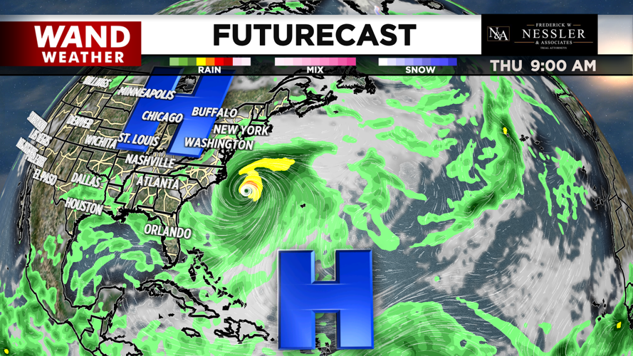

DECATUR, Ill. (WAND) - Behind showers and storms tonight, high pressure gradually moves in with cooler, milder, and calmer conditions. This area of high pressure will have another role, however, in the way Hurricane Erin plays out.
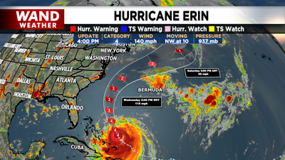
The latest 4pm CT update on Hurricane Erin shows a category 4 hurricane slowly moving northwest at 10 mph. Recent ensemble model runs all show a track that remains a few hundred miles off the southeast and Mid-Atlantic coast. This could still mean impacts such as tropical storm force winds, heavy rainfall, and flash rip currents to areas such as the Outerbanks and Carolina coasts.
High pressure will bring us dry conditions this week, and it will also act as a block along the East Coast. This helps to keep Erin from making landfall. Meanwhile, a ridge that has been guiding the hurricane during it's initial development will start to break down and drop south of the storm. The placement of these two highs will allow the hurricane to continue north before straying northeast.

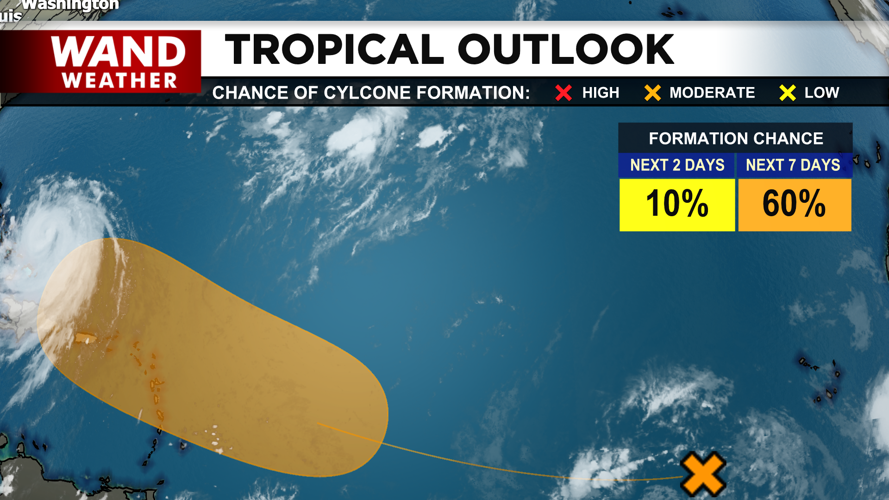
We'll continue to monitor any potential changes the track or impact, otherwise, our eyes turn to another tropical wave which may be forming into a tropical depression by the end of this week.

Copyright 2025. WANDTV. All Rights Reserved.


