


DECATUR, Ill. (WAND) - Gusty southerly winds working in conjunction with some sun made for a warm Monday. Some of that will hold true for Tuesday as well. There may even be record high temperatures despite more clouds than sun.
This run toward record temperatures will also be accompanied by a plethora of humidity. Initially, there will be a cap, or lid, on the atmosphere to prevent severe storms early in the day. The question is whether or not the cap erodes during the late afternoon/early evening or overnight.
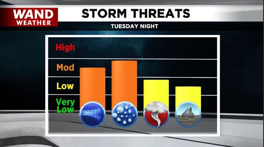
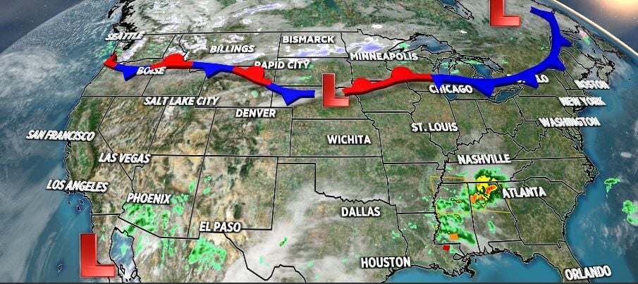
Thunderstorms will at first develop along a warm front later Tuesday, followed by more robust thunderstorm coverage later at night. The cap strength will dictate when severe weather (all modes are possible, unfortunately) returns. Last March featured 11 tornadoes across central Illinois. This could be the first for this March.
Have a way to get the latest watches/warnings and perhaps to wake you up when severe storms strike. I use the WAND weather app. It's free in your smartphone's app store. No hype, it truly is what I use.
Stay safe and stay weather-aware.
Copyright 2026. WANDTV. All Rights Reserved.


