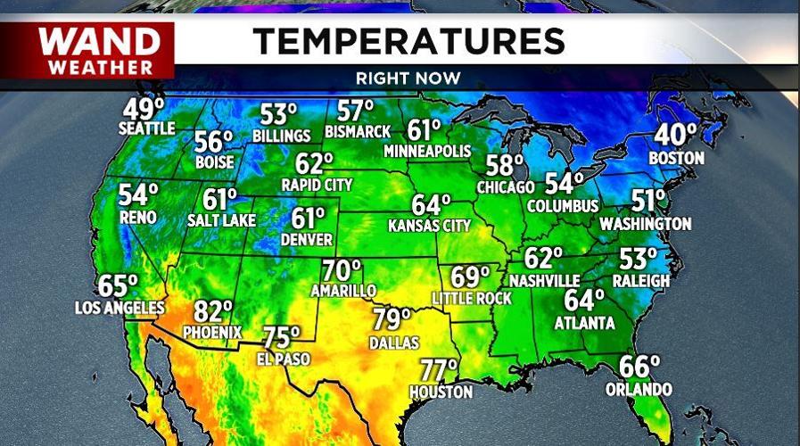

DECATUR, Ill. (WAND) - We've ridden a warm spell of weather for quite some time now, despite a couple bumps along the way (this past Sunday/Monday with accumulating lake effect snow). However, that's all about to change, and this time it'll last longer.
The current source region of air from the west-southwest will continue to pile in to start our weekend. If you're a fan of late-season warmth, then by all means make outdoor plans.
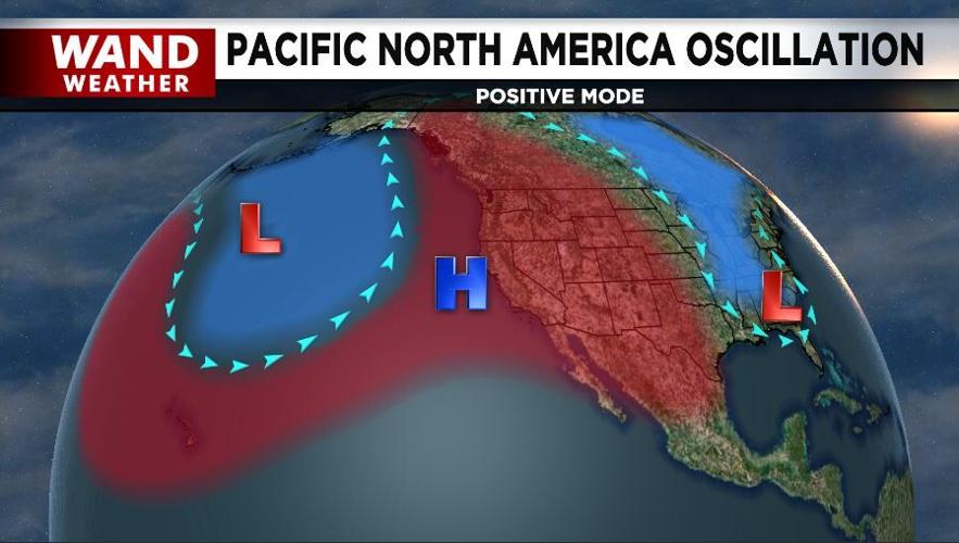
If you despise the warmth, then the forecast headed into December is for you! All signs point to a pooling of warm water over the Gulf of Alaska and just off the coast of British Columbia, Canada.
High-pressure systems forming over this warm pool will be the steering mechanism to draw Siberian-originated air into North America. The position of that high pressure, per the latest Pacific North America Oscillation that tracks pressure anomalies, will be crucial to developing a northwest-to-southeast wind aimed at Illinois from northwest Canada. WAND weather expects this to begin to take shape in the first half of next month.
Meanwhile, get outside and enjoy! Happy weekend.
Copyright 2025. WANDTV. All Rights Reserved.


