


(WAND) - The midweek will be feeling like the dog days of summer across Central Illinois as temperatures will be heating up into the low to mid 90s from today through Thursday.
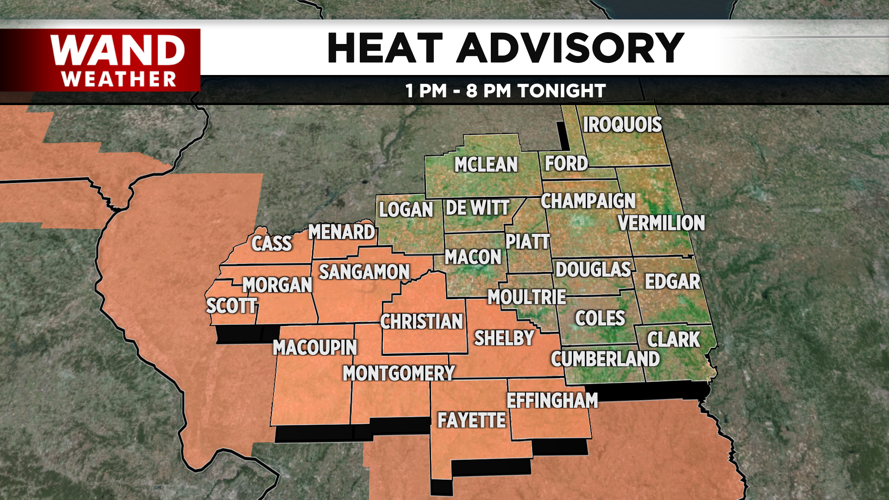
Humidity levels throughout the next few days will be nearly miserable; with dew points reaching the upper 70s at times. This will produce feels like temperatures into the triple digits. A Heat Advisory is in effect for southwestern and western counties for today, while Macoupin, Fayette & Montgomery Counties have the advisory through Thursday evening.
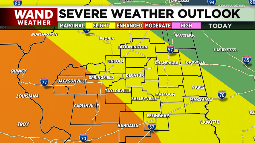
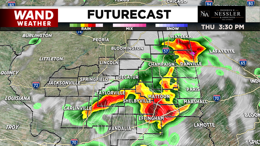
The other big concern besides the summertime heat and humidity, is the chance of strong to severe storms every day. Tuesday's threat will be mostly during the late afternoon and early evening, but a few are also possible during the overnight too. Wednesday's storms will be mostly in the morning & late overnight. Thursday's chances also trend with a few in the morning but also more in the afternoon to early evening.
The biggest concern of the strong to severe storms is damaging winds, but an isolated tornado and large hail are also possible. Friday will bring the final round of storms, as a cold front pushes through the area. This will lead to slightly less humidity & a small drop in the temperatures into the upper 80s for a mainly rain-free weekend.
Meteorologist Anthony Peoples
Copyright 2024 WAND TV. All rights reserved.


