(WAND)- WAND Stormcenter Meteorologists continue to track the possibility of a major winter storm. Warm temperatures are still expected today, allowing precipitation to start out as scattered showers until it transitions to sleet/freezing rain/snow as temperatures drop this evening.
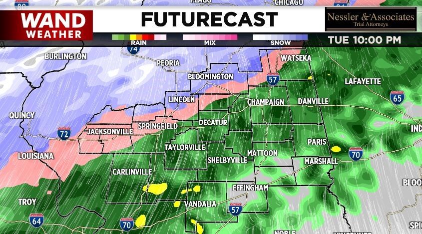
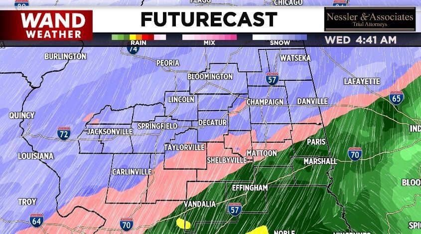
Heavy snow will impact morning and evening commutes, Wednesday, for anyone traveling near I-72 and I-74. Freezing Rain and Sleet will cause ice concerns for commuters closer to the I-70 corridor. Eventually, everyone will see snow come Thursday morning.
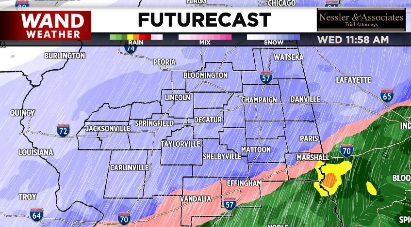
Heavy snowfall will lead to major travel issues on roadways starting Wednesday morning until Thursday evening. The heaviest snowfall will be points furthest North, while heavier ice accumulation will be near the I-70 corridor.
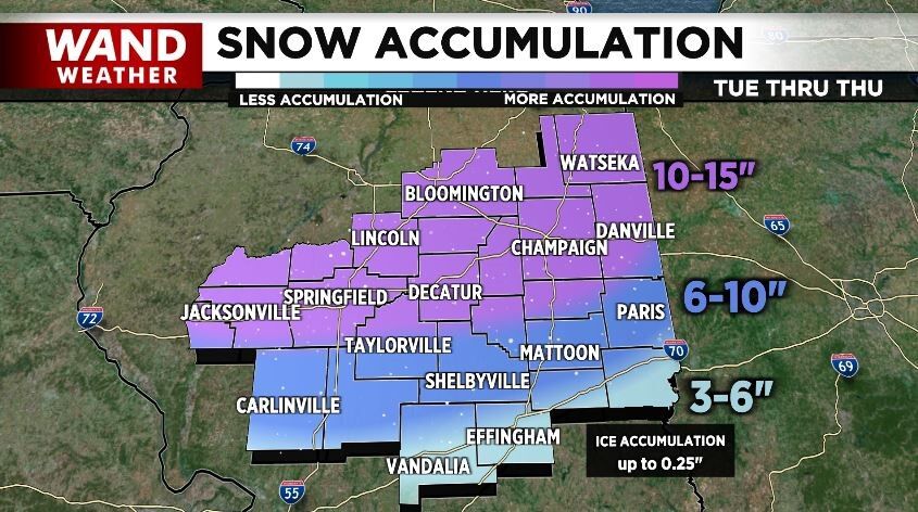
While the forecast calls for 10-15", blowing snow will be of concern as certain areas could see up to 5 feet of snowdrift.
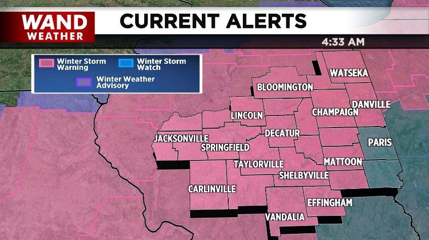
National Weather Service has already issued a Winter Storm Warning (Pink) for majority of Central Illinois until 6 pm on Thursday, February 3rd, 2022. A Winter Storm Watch (Blue) is in place for Edgar and Clark County starting Wednesday morning until Thursday evening.
Meteorologists suggest avoiding any travel over the next 72 hours, but ultimately road conditions determine when it will be okay to travel again. If you do have to travel this week, even if that’s to work, allow extra time for commutes, travel slowly, and be cautious. This system will be talked about for years to come.


