LINCOLN, Ill. (WAND) - Record flooding is occurring across parts of Central Illinois as several storms produce tornadoes.
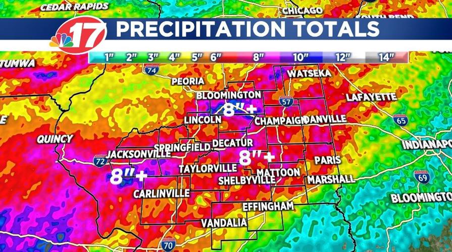
Rainfall amounts of more than eight inches have been reported since Thursday in some hometowns.

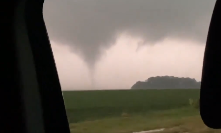
Along with the heavy rain, several brief tornadoes have touched down since Thursday.
A tornado briefly touched down Thursday night near Virden, just south of the Sangamon and Macoupin County line.
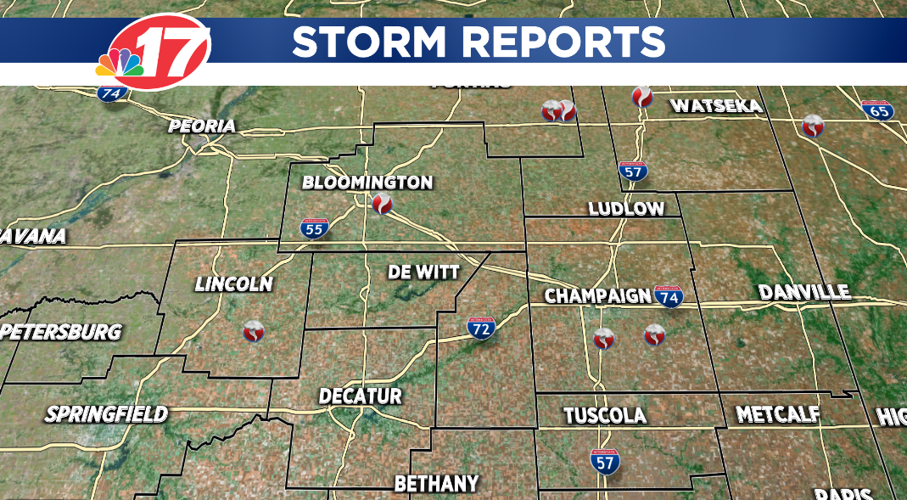
The weather became active again Friday afternoon and evening when a tornado touched down near Fisher in Champaign County at 5:27 p.m. and at 6:05 p.m., a brief tornado was reported around Cisco in Piatt County.
A third tornado touched down near Weldon in De Witt County about 6:15 p.m. Friday.
And, about two hours later, an EF0 tornado (winds of 65-85 miles-per-hour) caused damage to crops and trees near Downs in McLean County at 8:25 p.m.

Numerous tornado warnings were active across Central Illinois Saturday afternoon.
A tornado was confirmed near Cornland in southern Logan County around 3:35 p.m. It was also rated EF0.
A second tornado was reported around Danforth in Iroquois County.
In addition to these tornadoes, there might have been one more.
Chris Miller, the Warning Coordination Meteorologist with the National Weather Service office in Lincoln, says his office is still looking over radar data and talking with emergency management officials to see if it can confirm any more tornadoes.


