
(WAND) - Very warm spring-like weather continues across central Illinois.
More Very Warm Weather
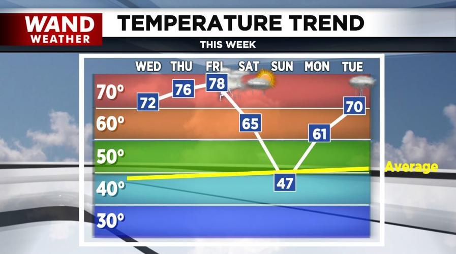
Highs today will reach the low-70s again, warm into the mid-70s Thursday, and to record or near record highs Friday in the upper-70s.
While we'll see more clouds today than the past few days, sunshine returns Thursday into Friday.

Along with the very warm weather Friday, winds will be gusting to 40-50 mph.
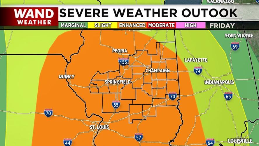
Severe storms are still forecast Friday evening into early Friday night. At this point, damaging winds will be the biggest threat, but large hail and a few tornadoes can't be ruled out.

It'll remain rather windy Saturday with a few late day showers possible. Sunday will be much cooler with highs in the 40s.
Meteorologist Anthony Peoples
Copyright 2025 WAND TV. All rights reserved.


