

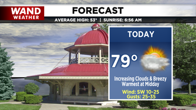
DECATUR, IL. (WAND) - Happy Sunday! We are tracking a cold front that will move in today and bring a shift to our warm and settled weather pattern.
Temperatures today warm to the upper 70s early in the day. Some may hit 80 degrees by midday, but by then, clouds will have rolled in, creating overcast skies for the afternoon.
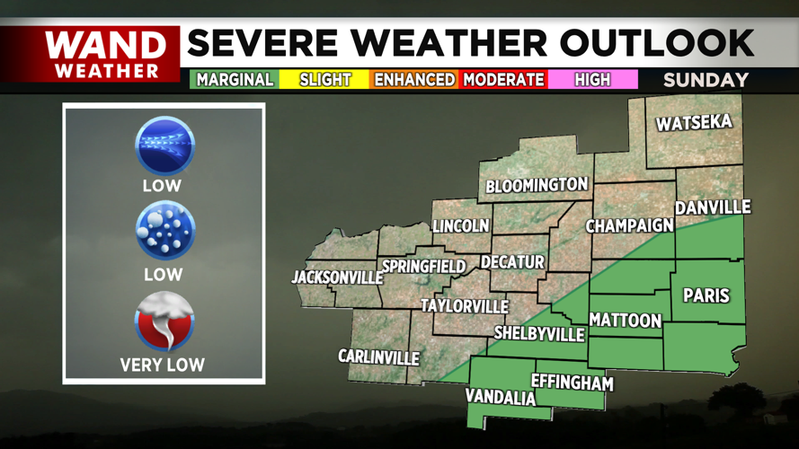
The cold front brings increasing chances for spotty, isolated showers by the evening, and areas southeast of I-72 may even see a few thunderstorms fire up. The front and associated storms will also bring gusty winds.

A marginal risk for severe thunderstorms is in place for a portion of the region. Some severe wind gusts will be possible within the storms. We also can’t rule out hail if storms turn severe.
Behind the rain, we dry out and clear out, and the clear skies paired with strong northerly flow will usher in the return of seasonably cold overnight lows in the low 30s.
Copyright 2026. WANDTV. All Rights Reserved.


