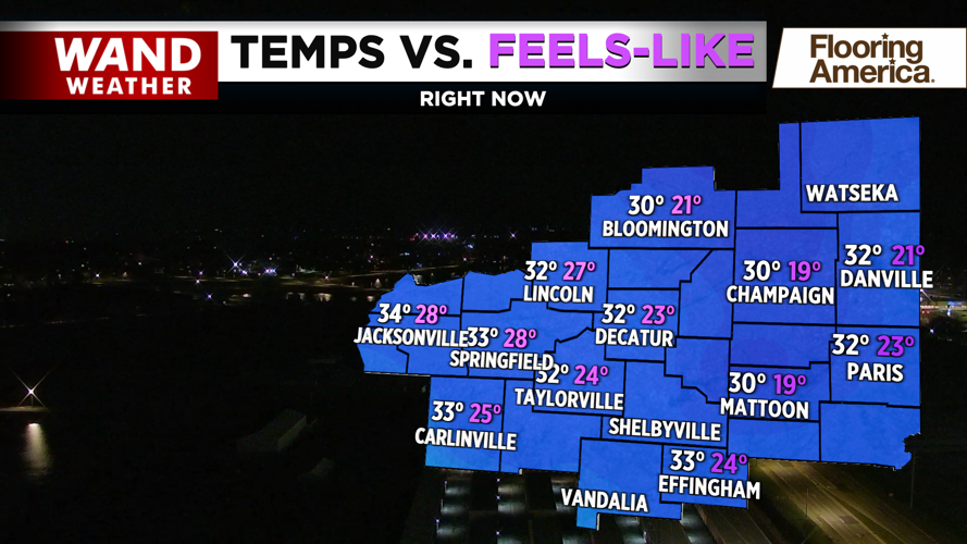
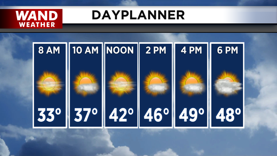


DECATUR, IL. (WAND) - Happy Monday! After a very warm weekend, temperatures have plummeted behind a cold front. Wind chills are in the low 20s and teens this morning, with actual temperatures in the low 30s. This is over 30 degrees colder than the 60s we woke up to on Sunday morning. Temperatures will warm up throughout the day, but highs will be much closer to average in the low 50s.
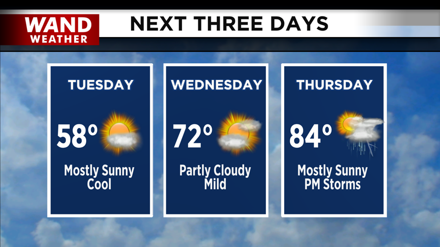
Temperatures will again plunge overnight tonight into Tuesday morning. Temperatures will warm up into the upper 50s by the afternoon. Wednesday will be much warmer with temperatures warming into the upper 60s and low 70s. The hottest day of the week will be Thursday as highs climb into the 80s.
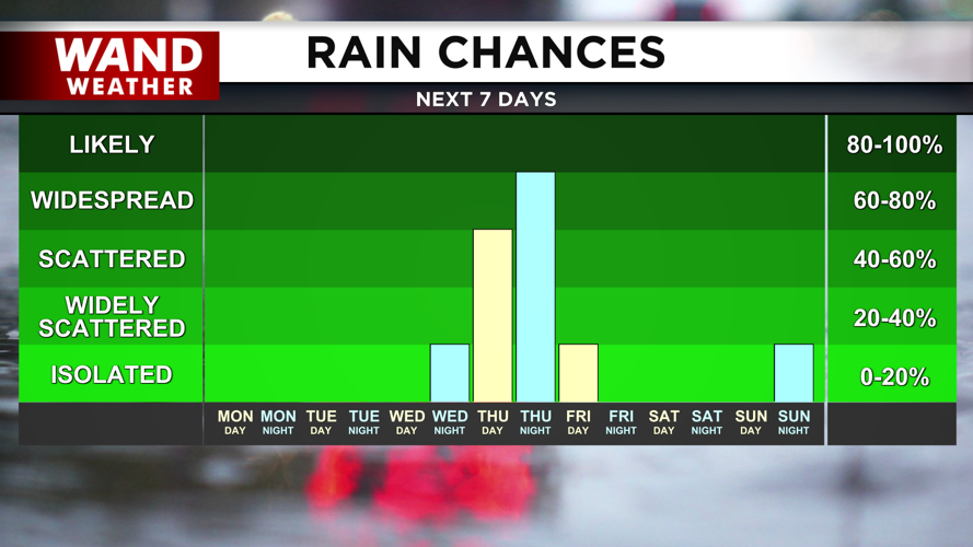
Thursday will also be our next chance for severe thunderstorms as another system will move into the Midwest. The timing of this looks to be in the evening and overnight, but we will watch for changes in the timing and intensity throughout the week. Temperatures will plunge behind the storms, with highs back in the 40s by Friday.
Have a great week!
Copyright 2026. WANDTV. All Rights Reserved.


