

DECATUR, IL. (WAND) - Happy Saturday! The weekend starts on a quiet note, but our next weather maker will bring both severe and winter weather by tomorrow evening.
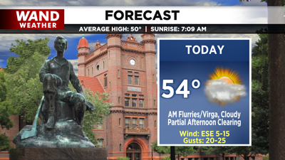
Radar looks busy this morning, but dry air at the surface keeps us quiet. Mostly cloudy skies start the day, but a period of partial clearing arrives this afternoon. Areas that can get more sunshine may warm to the mid-50s. It’s short-lived, however, as we get ready for our next low-pressure system to move in. We’re tracking cloudy skies by tonight, keeping lows in the upper 40s.

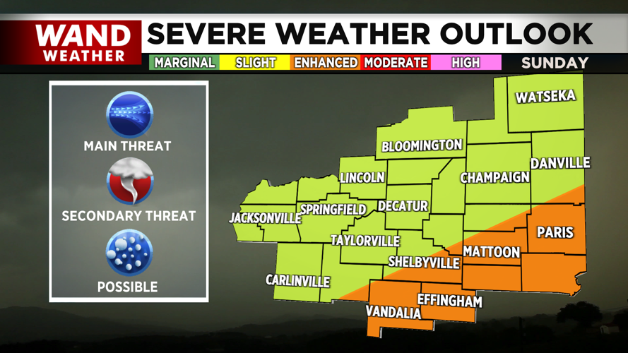
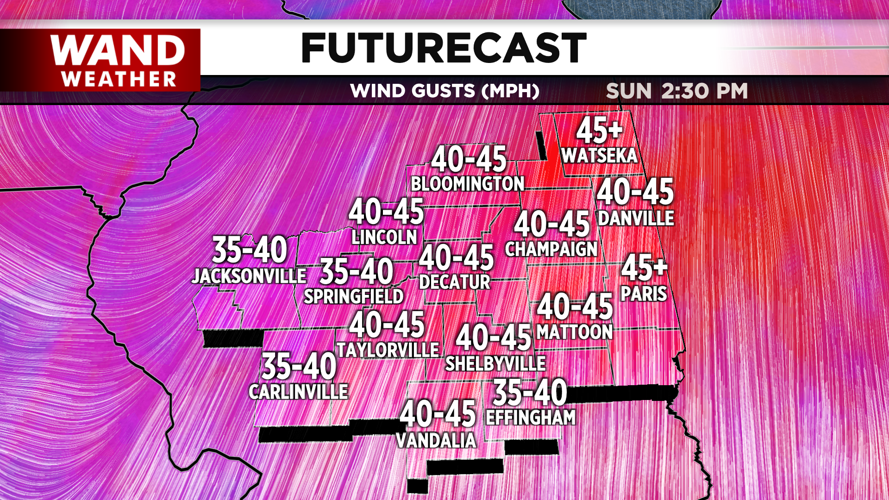
By tomorrow morning, isolated showers will be possible early, but we’ll hold off on the majority of the strong thunderstorms for the late evening. Our main concern will be damaging winds, but we can’t rule out an isolated tornado or large hail. An enhanced and slight risk is in place across the region. Wind gusts are forecasted to peak over 50 mph, and may prompt a few wind alerts for tomorrow afternoon into Monday.


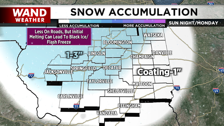
Behind the storms, cold air plunges in. This will allow a transition to snow overnight into Monday morning. At least a coating to a couple of inches could be left behind, especially on grassy surfaces. However, as snow melts overnight and temperatures drop, a flash freeze may create a slippery morning commute on Monday. Use extra caution as we head into the work week.
Have a great weekend and stay weather-aware!
Copyright 2026. WANDTV. All Rights Reserved.


