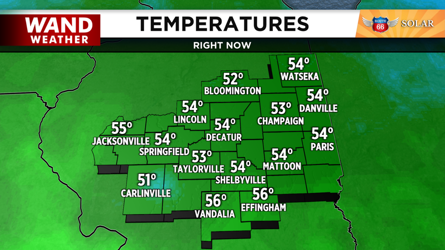
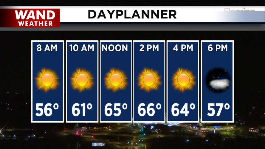


DECATUR, IL. (WAND) - Happy Wednesday! The wind advisories have expired, but strong winds around 20 to 30 mph out of the southwest will hang around through the morning. These winds have allowed temperatures to soar into the 50s overnight. Sunny skies will lead to near record-breaking high temperatures in the upper 60s for the afternoon.

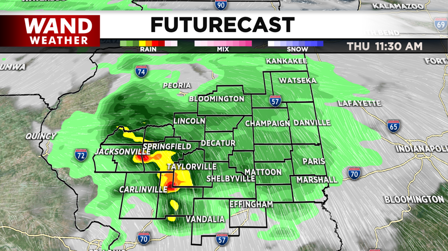
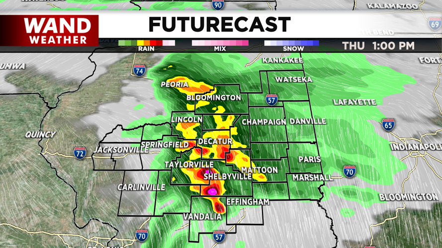
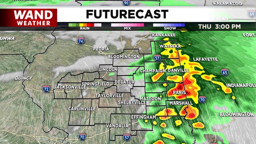
Clouds will build into the area overnight and lead to a mostly cloudy start to Thursday. An approaching cold front will lead to chances for scattered showers and thunderstorms on Thursday morning. Strong to severe storms are possible from the late morning through the late afternoon. Models are indicating that storms will be scattered, but could produce all modes of severe weather. Strong wind gusts will be the biggest threat, but isolated tornadoes can’t be ruled out. Storms should exit by Thursday evening.


Temperatures will plunge overnight into Friday morning behind the cold front. Seasonable conditions in the 40s will return Friday and Saturday afternoon. Light flurries are possible Sunday afternoon as temperatures drop below freezing for the start of next week.
Copyright 2026. WANDTV. All Rights Reserved.


