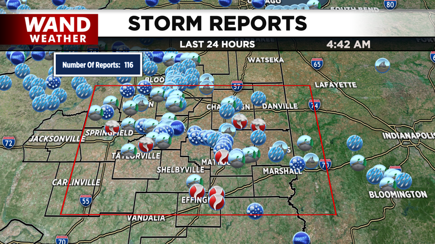
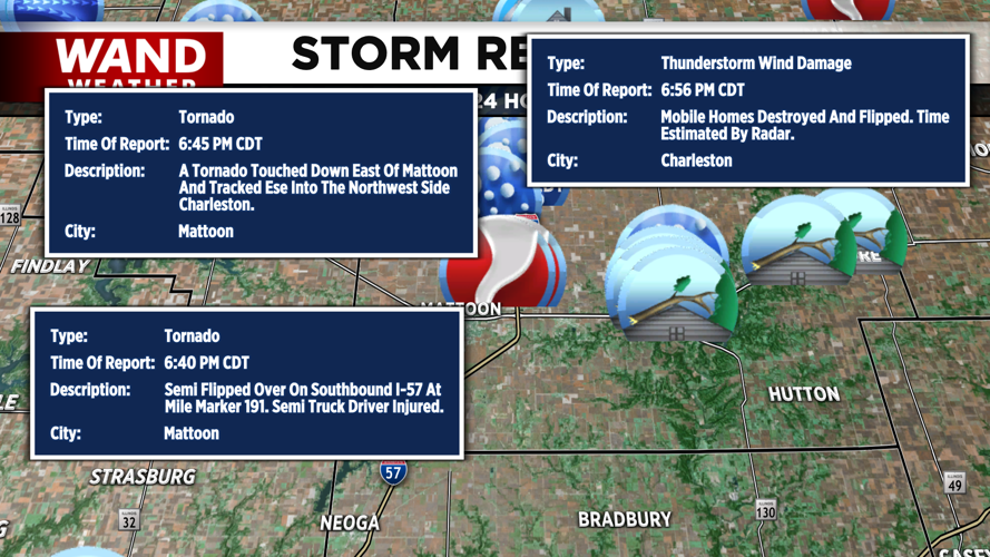


DECATUR, IL. (WAND) - Happy Thursday! The severe weather threat has moved out of Central Illinois. There were over 100 storm reports in Central Illinois from yesterday's storms, but some of the hardest hit areas were in Coles and Effingham Counties. Those areas had confirmed tornadoes on the ground, and the National Weather Service will conduct damage surveys over the next few days to assess how strong they were.
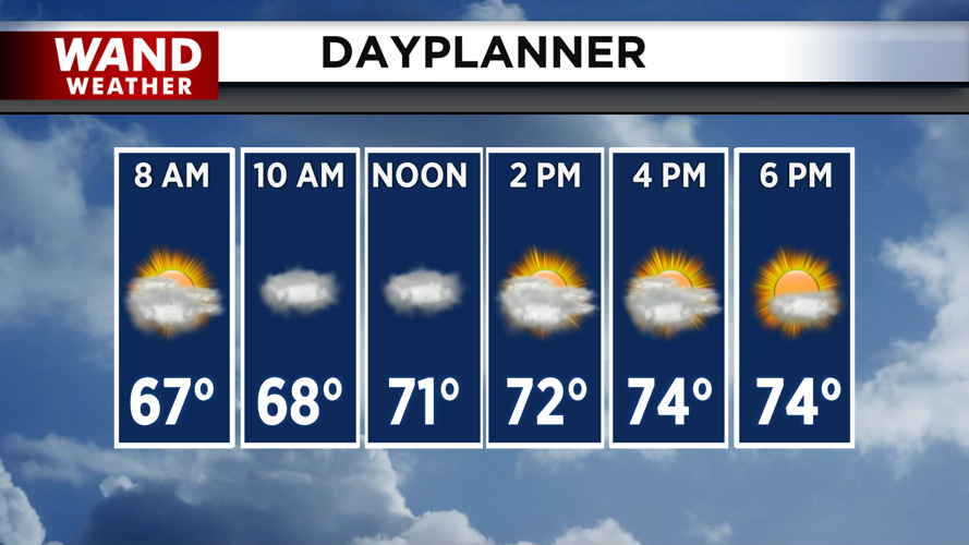
It will be a much calmer, cooler stretch of weather over the next few days. Expect a mostly cloudy start to the day with mild temperatures in the 50s. Clouds will dissipate throughout the afternoon, and we should have some sunshine to close out the day. Temperatures will only climb into the mid-70s for the afternoon.
Friday and Saturday are looking calm and mild. Temperatures will warm up into the low 80s both days with a mix of sun and clouds. Summer will officially begin on Father’s Day. It will be a soggy Sunday afternoon with rain chances ramping up for the afternoon. There could be a few scattered storms, but there is no severe threat at this time.
Copyright 2026. WANDTV. All Rights Reserved.


