
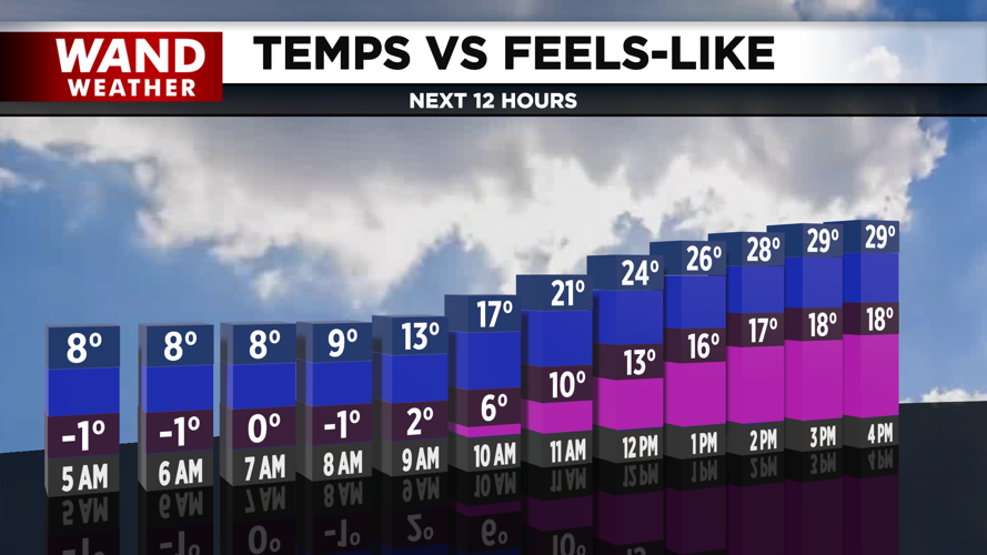

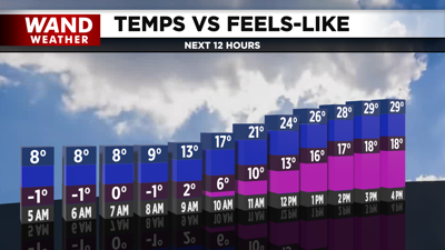
DECATUR, IL. (WAND) - Happy Tuesday! The dangerously cold air is starting to warm up today. Wind chills will climb from the single digits into the upper teens and low 20s by the afternoon. Winds will bring in warmer air out of the south and west this afternoon, but actual temperatures will stay below freezing.
Temperatures tonight will be much warmer, with lows bottoming out in the mid-20s. Temperatures are expected to rise throughout the night, and above-freezing conditions are forecast to return by Wednesday morning. Wednesday will be the warmest day of the week, and could be the hottest day for the next 7 to 10 days.
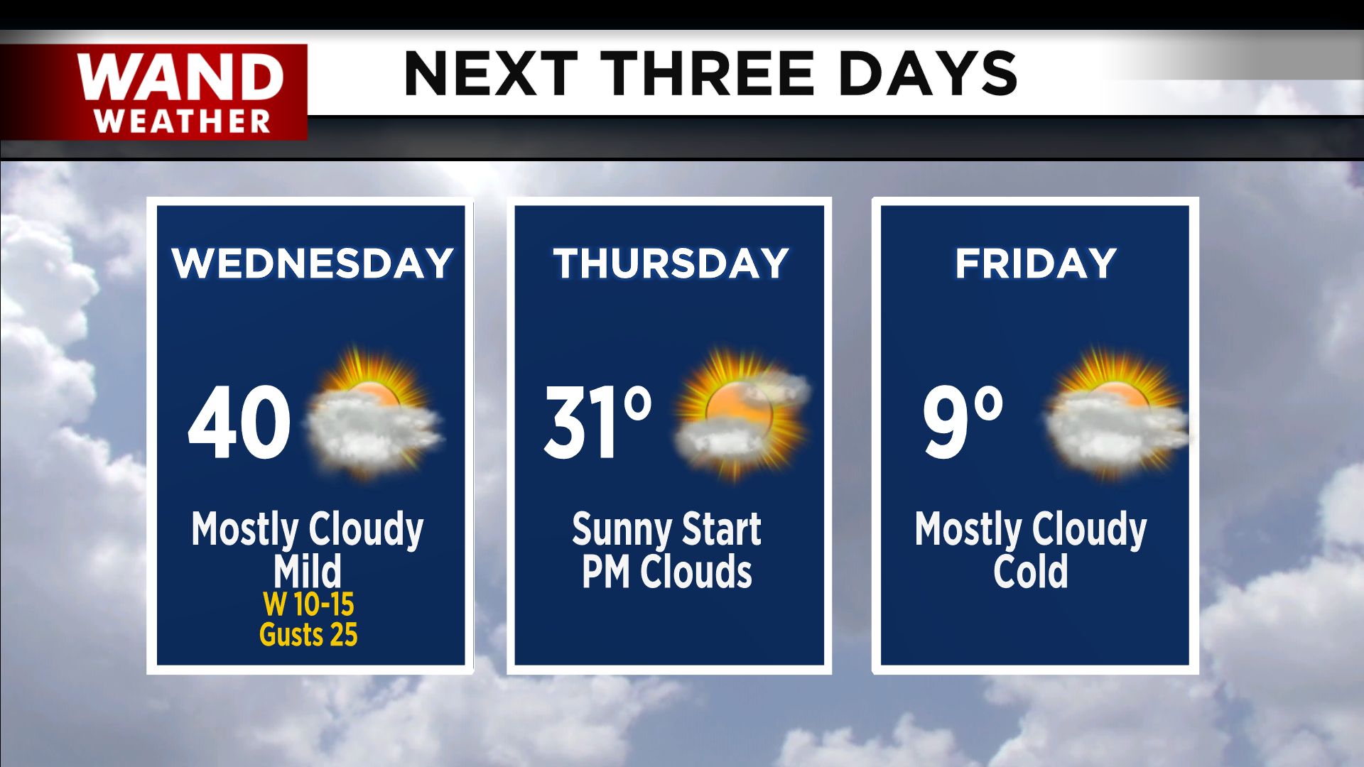
Another system will move through the region on Thursday. This cold front will usher in another blast of arctic air. Temperatures will drop below freezing on Wednesday night, and we might stay below freezing for the rest of the month.
A clipper system could bring in some significant snow chances to the Midwest by the weekend. Models are going back and forth, but they are showing snow in Central Illinois. We will monitor this system over the next few days and look at how it could impact us into next week.
Copyright 2026. WANDTV. All Rights Reserved.


