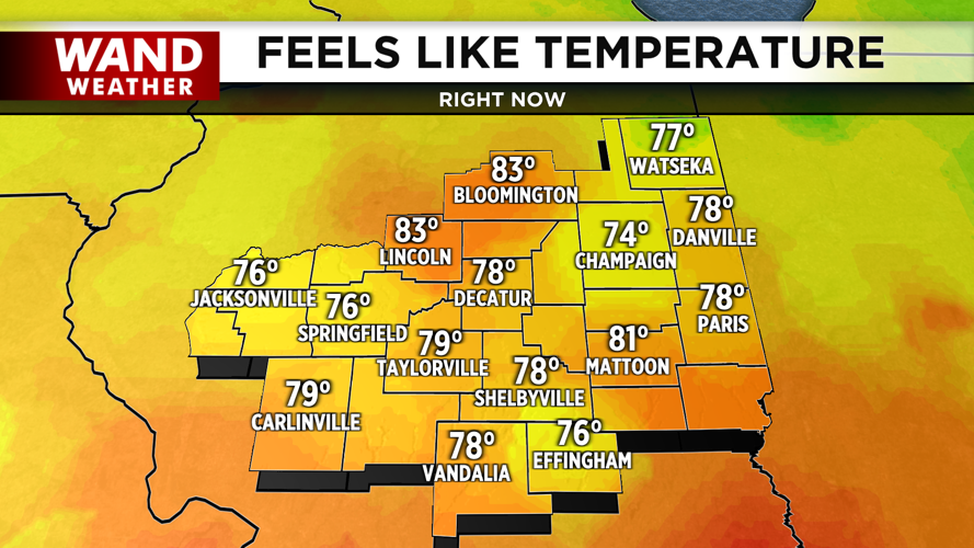


DECATUR, IL. (WAND) - A cold front is moving through Central Illinois this morning, bringing relief from yesterday's storms and ushering in noticeably calmer conditions for the rest of Tuesday.
The front will push south through the region later this morning, bringing drier air and lower humidity levels that will make a big difference in how the day feels. While clouds will stick around as the front moves through, rain chances are minimal — you can plan outdoor activities without worry.
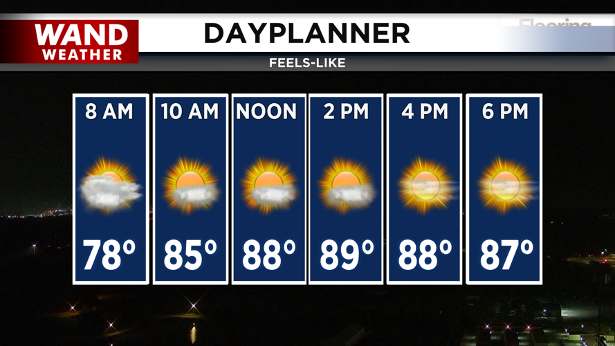
What to expect Tuesday: Temperatures will reach the mid-80s, but here's the good news — it will feel much cooler than yesterday, with feels-like temperatures only in the upper 80s. Sunny skies will break through later in the day as the front clears the area.
Tonight into Wednesday: Clear skies overnight will allow cooler air to settle in, and you'll notice the difference when you wake up Wednesday morning. Temperatures will dip to the low 60s
Wednesday is shaping up to be the most comfortable day of the week. Humidity will stay low, and feels-like temperatures will match actual temperatures in the low 80s. It's a great day to be outside.
The rest of the week: Humidity will gradually build back into Illinois as we move toward the weekend. Thursday will be slightly warmer with highs in the mid-80s, near normal levels.
Rain returns Friday. A cutoff low-pressure system will move into the Midwest, bringing scattered showers, possibly Friday evening. Rain will become steadier overnight into Saturday with scattered storms possible. Temperatures on Friday will be cooler, in the low 80s, with rain in the forecast. Rain chances will linger off and on Saturday as the low-pressure system moves eastward.
Copyright 2026. WANDTV. All Rights Reserved.


