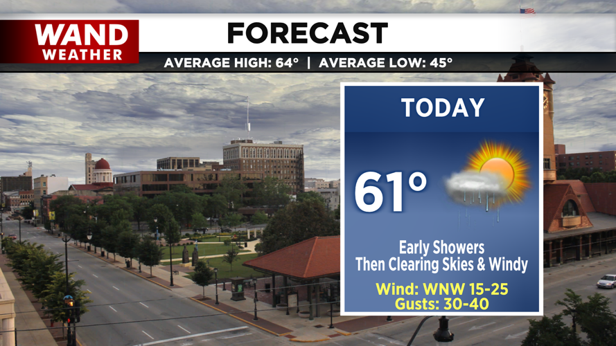


DECATUR, IL. (WAND) - Happy Sunday! As our weekend cold front continues eastward, quiet, cool, and windy conditions are left in its wake.
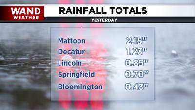
Rain totals yesterday peaked well over 2 inches for areas to the southeast such as Mattoon, and farther northwest, totals were closer to the ¾ of an inch mark. Rain continued overnight and into today, meaning more updates on rainfall totals will be on the way by this evening.

Isolated showers linger early this morning before tapering off by mid-morning. By this afternoon, we’ll return to mostly sunny skies with highs in the low 60s. Winds will pick up behind the departing low with gusts up to 40 mph. We can expect the gusty winds and clear skies to continue this evening with overnight lows dipping into the upper 30s.
Tomorrow will be another windy and cool day. Wind gusts up to 35 mph will remain in the forecast through Tuesday as a less potent low swings through. This may bring a few isolated showers early Tuesday, otherwise, it will help to continue to the cooler pattern through the midweek.

Copyright 2025. WANDTV. All Rights Reserved.


