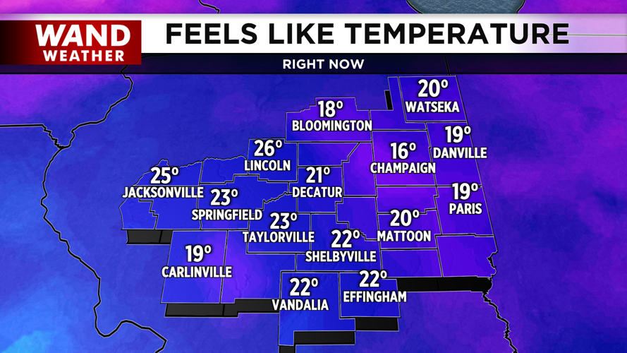

DECATUR, IL. (WAND) - Happy Wednesday! Temperatures continue to climb with wind chills in the double digits this morning. It is by far the warmest morning of the week so far. Temperatures will end up in the upper 30s and low 40s through the afternoon. Clouds will give way throughout the day, and we can expect sunshine for the second half of the day.
Winds will pick up this evening and shift from the south to the north. This will drive in cooler air overnight. Temperatures will drop back into the 20s overnight, and cold air will take over for the rest of the week. Temperatures will struggle to warm up above freezing on Thursday afternoon.
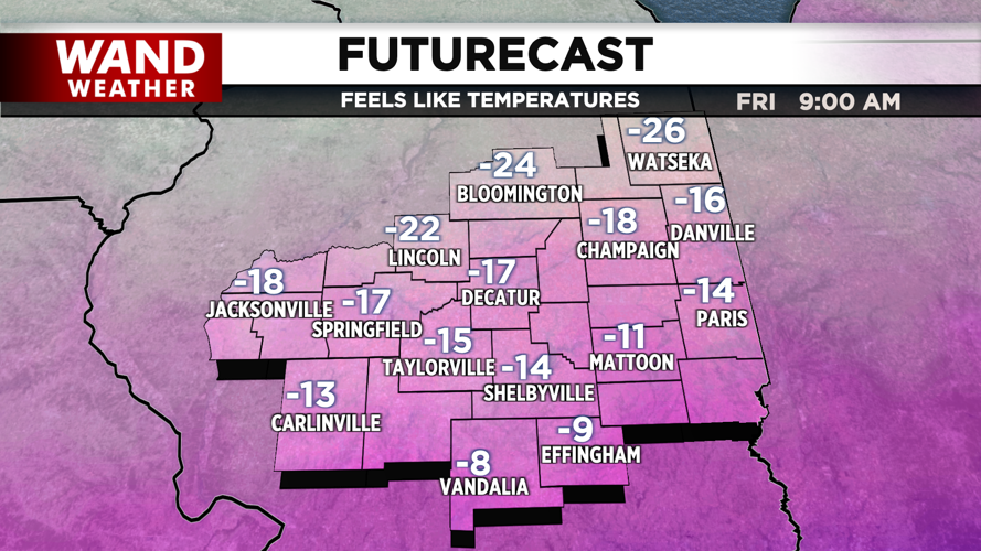
Dangerously cold temperatures will arrive for the weekend. Temperatures will drop below 0 Thursday night into Friday, and high temperatures will stay in the single digits on Friday afternoon. The extreme cold will hang around for Saturday with overnight lows in the negatives.

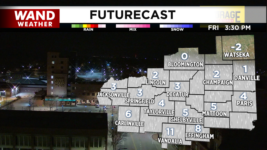
Snow chances are starting to creep northward as a big winter storm system is expected to move across the United States Saturday into Sunday. It’s still too early to tell, but some snow Saturday afternoon into Sunday is possible. The weather team will continue to monitor any changes as that system approaches.
Copyright 2026. WANDTV. All Rights Reserved.


