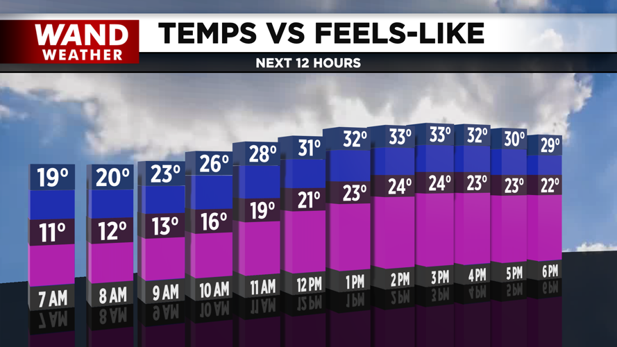

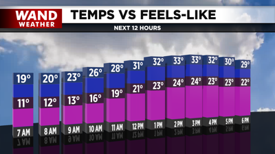
DECATUR, IL. (WAND) - Happy Thursday! The arctic chill is just around the corner, and a cold weather advisory has been issued for most of Central Illinois. With wind chill values expected to drop into the -10 to -20 range. Temperatures this afternoon will be right around average in the low 30s. This will be the warmest day for the next 7 days as the cold air takes over.

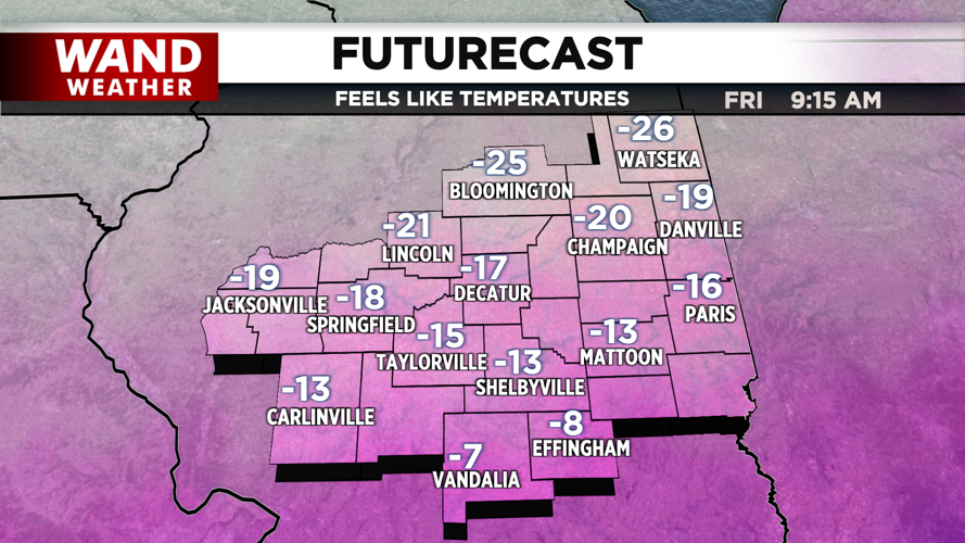
Temperatures tonight will drop quickly with winds out of the north. Actual temperatures will drop to right around 0. Highs tomorrow afternoon will only climb a few degrees. Winds will calm down throughout the day, but it will still be dangerously cold through Friday night into Saturday.

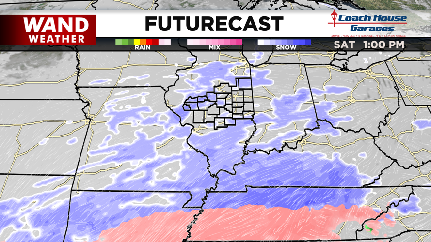
Snow chances will move into Illinois by the middle of the day on Saturday. The initial wave of snow still looks mild for areas north of I-70. The snow totals on Saturday look minimal, with 1 to possibly 3 inches of snow through Saturday night, but heavier snow could impact us again on Sunday. Another wave of snow will move in from the south, and this could be more impactful. Those snow totals are still uncertain, but we will monitor any changes in the models over the next two days.
Copyright 2026. WANDTV. All Rights Reserved.


