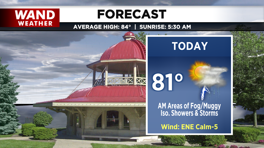
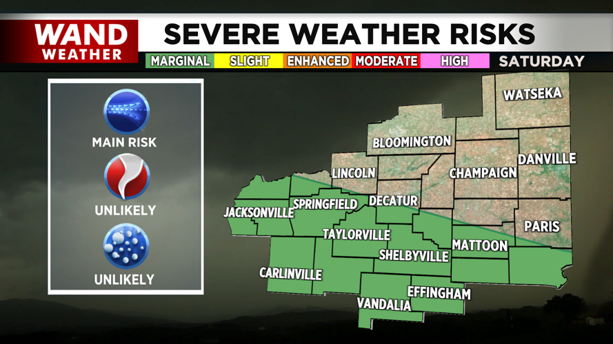

DECATUR, IL. (WAND) - Happy Saturday! We start the weekend muggy and foggy this morning. A stationary front draped across the Ohio River Valley into the northeast will allow for a few more rounds of light showers and isolated storms throughout the day. By tomorrow, we'll dry out and turn up the heat.


Isolated showers throughout the day will be more hit-and-miss through the first half of the day, but tonight, those south of I-74 may see a few scattered light showers, along with a few isolated thunderstorms. We can’t rule out an isolated strong to severe thunderstorm tonight, especially after the daytime warm-up into the low 80s.
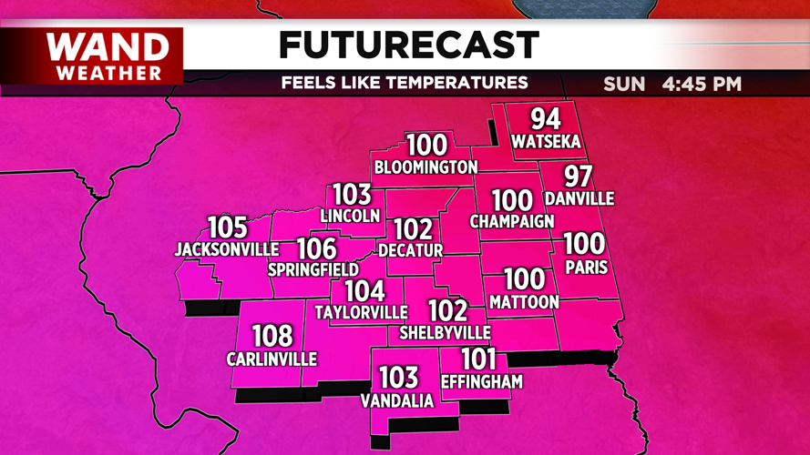
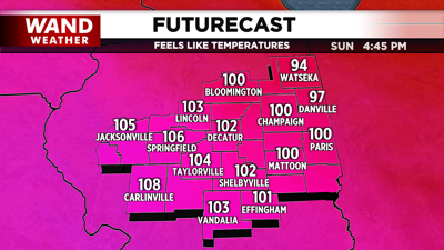
By tomorrow, we are drying out in the morning, but we’ll get another round of patchy dense fog. However, as sunshine returns in the afternoon, temperatures will warm to the upper 80s near 90 degrees, and the humidity will leave us feeling like the low 100s. Several days with similar excessive heat concerns are on tap for the week, so do what you can to stay cool.
Have a great weekend!
Copyright 2026. WANDTV. All Rights Reserved.


