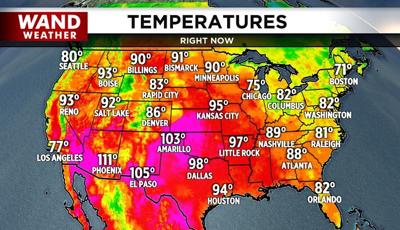

DECATUR, IL. (WAND) - Heavy to severe storms that reared their ugly head across parts of the region earlier today will drift away early tonight. These storms were part of a cool front settling southward from the High Plains and Great Lakes.
The origin of the air in the wake of this front will be out of the northeast Tuesday. Will it be humid? Sure! Just not AS humid. The most comfortable air will arrive Tuesday night into Wednesday before humidity gets another bump up later this week in advance of our next round of thunderstorms.
So, if you're tired of the extreme heat, it will begin to abate. Just keep in mind, it's still summer, and we're definitely going to have more heat before the leaves change color.
Copyright 2026. WANDTV. All Rights Reserved.


