

DECATUR, IL. (WAND) - Central Illinois is bracing for a significant weather shift. A cold front will trigger strong to severe thunderstorms Thursday evening and overnight, bringing the threat of heavy rain, damaging winds and potential flooding to the Decatur area.
Building Heat and Humidity Wednesday
Wednesday will feel deceptively pleasant with mostly sunny skies and a high near 87 degrees. However, humidity will increase throughout the day, making it feel closer to 91 degrees. Overnight, temperatures will drop to a comfortable 68 degrees, but it's the calm before the storm.
The Main Event: Thursday Night Storms
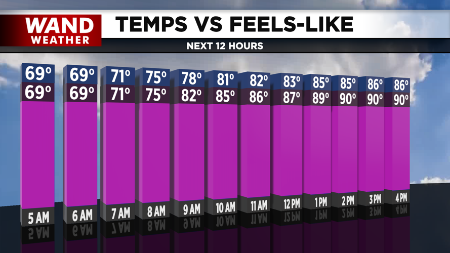
Thursday will be the turning point. Clouds will increase throughout the day as a cold front approaches Central Illinois. The high will reach 90 degrees, but with increasing humidity, feels-like temperatures will climb into the mid to upper 90s — making it feel more oppressive than the actual temperature.
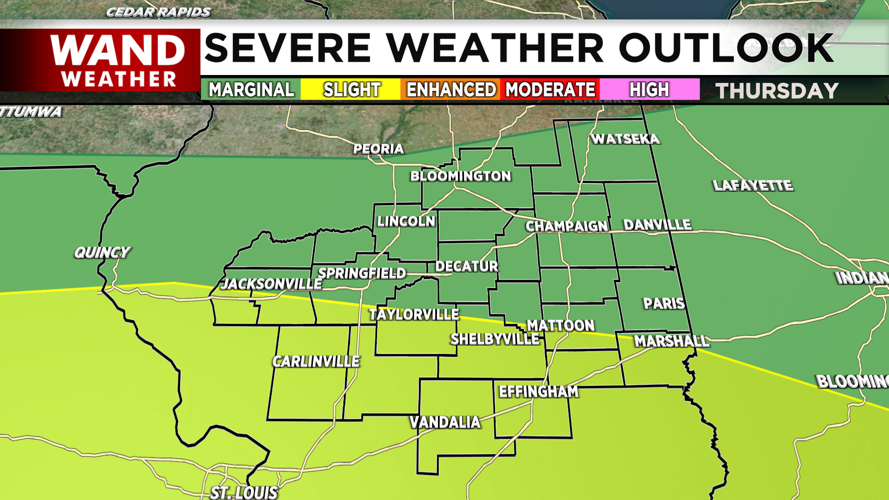
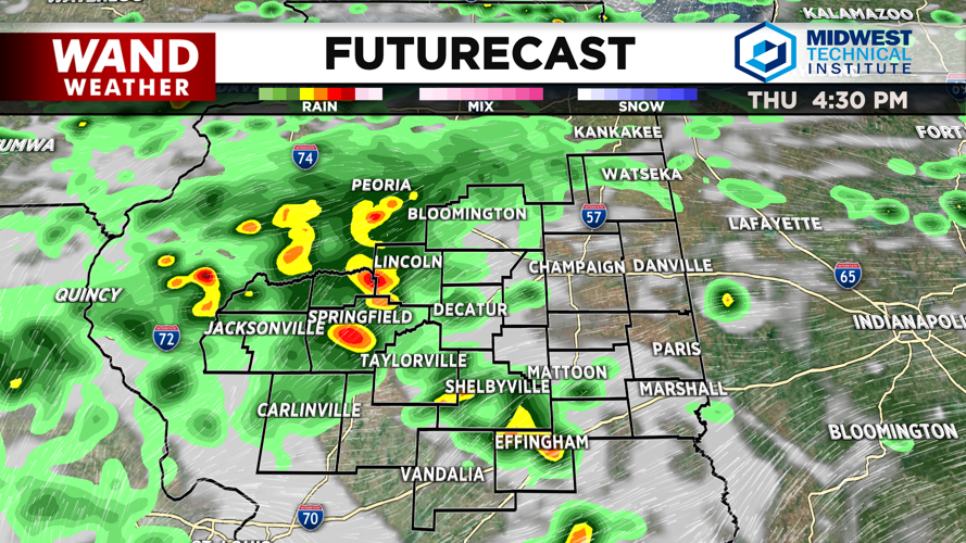
As evening approaches, storm chances will ramp up significantly. The cold front is expected to stall out across Central Illinois, triggering strong to severe thunderstorms Thursday night into Friday morning. The WAND Weather team is monitoring a slight risk for severe weather, with the primary threat being heavy rainfall and flooding.
Rainfall amounts of 2 to 3 inches are possible with these storms, which could lead to localized flooding in areas prone to water accumulation. Damaging winds are also possible with the strongest storms. The overnight low will be around 70 degrees, but most people won't see it as storms move through.
Storms Linger Friday, but Clearing Expected
Friday will start wet, with storms lingering across the area early in the day. However, model guidance suggests the frontal boundary will push southward, which should limit the overall impact of flooding and rain as the day progresses. The high will be 86 degrees, with an overnight low of 67 degrees.
Drying Out Over the Weekend
Saturday will see improving conditions. A few lingering showers are possible Saturday morning, but mostly dry weather should return by the afternoon. The high will be 84 degrees with an overnight low of 66 degrees.
Sunday looks much better with mostly sunny skies and a high of 87 degrees. Overnight, temperatures will drop to 67 degrees.
Looking Ahead
Warmer temperatures and sunny skies will move in for next week, bringing a return to more typical summer weather after the stormy pattern clears out.
Copyright 2026. WANDTV. All Rights Reserved.