


DECATUR, IL. (WAND) - Happy Saturday! Snow has begun to fall across central Illinois. Bands of heavy snowfall are moving throughout the region with gusty winds up to 35 mph. This will limit visibility throughout the rest of the morning and afternoon.
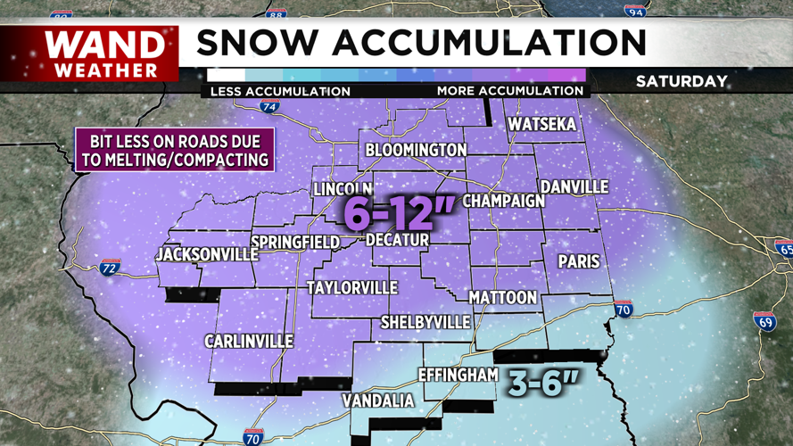
1:30 PM Update: Heavier snow totals are expected farther south. Areas as far south as Macoupin, Shelby, and Coles counties could expect snow up to 12 inches as well.

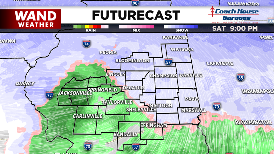
We can expect snowfall, gusty winds, temperatures in the low 30s and lowered visibility all day today. Use caution on the roads. Tonight, we’ll briefly transition to a rain/snow mix in the evening, but as colder air in the low 20s returns behind the front, we’ll be back to snowflakes by early tomorrow morning.

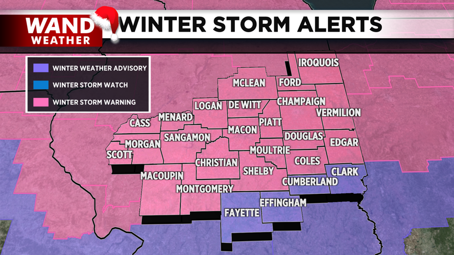
By the time snow wraps up, we can expect snow totals from 6 inches to a foot across areas highlighted under the Winter Storm Warning. Our Winter Storm Warning and Advisory will expire overnight.

Tomorrow will be mainly dry, but a few more snowflakes are on the horizon for Monday night.
Copyright 2025. WANDTV. All Rights Reserved.


