


This forecast is not current as of Saturday 1 a.m.
(WAND) — The warmest day of the year thus far comes at a price.
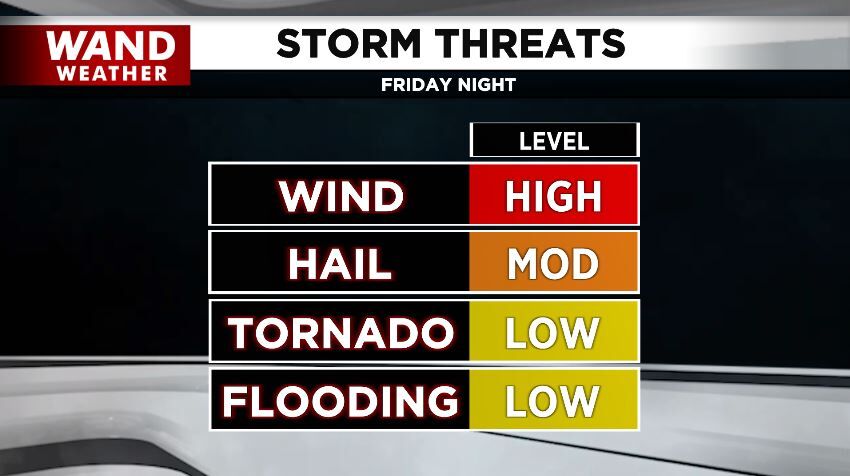
For some of us, it will be too hefty of a price in the form of damaging wind.
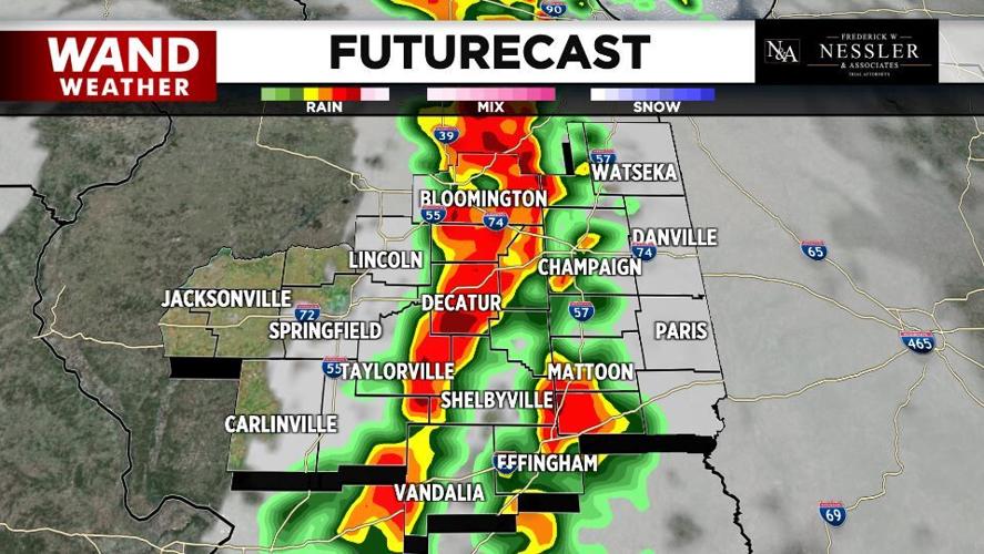
A broad southerly flow of air out of the Gulf Coast states will continue to pump in moderately high humidity. This will combine with drier air above our heads and an approaching storm to ignite those damaging wind gusts.
The wind has been consistently gusting over 40mph through Friday afternoon in advance of said storm.
However, as rain begins to fall into that drier air above our head, the increased evaporation will cool the air, making it denser and allowing it to rush down to the ground.
A north-south oriented line of thunderstorms will create more widespread gusts over 80 mph.
That could topple an 18-wheeler, and the strongest gusts could end up being a bit higher!
So, while a quick spin-up tornado is possible within this line of thunderstorms, the amount of real estate encompassed by a tornado will likely be small compared to the direct damage from thunderstorms.
Those that have patio furniture outdoors should bring it inside along with any other loose items.
We anticipate power outages, so having a working flashlight and/or cell phone fully charged is a must.
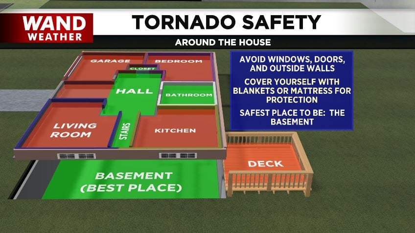
Know your safest location to be when the strong wind hits this evening into the overnight hours.
The WAND Weather App has watches and warnings that track you along with current and futurecast radar.
If all this weren't enough, large hail up to 2" in diameter is possible, so if you have a garage or carport, use it and stay safe!
Copyright 2025. WAND TV. All rights reserved.


