


(WAND) - Severe storms are possible Tuesday afternoon into Wednesday and Thursday across Central Illinois.
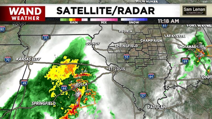
Clusters of non-severe thunderstorms moved through the area Tuesday morning.
Severe Weather Still Possible This Afternoon
Severe storms over southwestern Missouri are racing northeast at about 50-55 miles-per-hour and will graze our southern and southeastern hometowns.
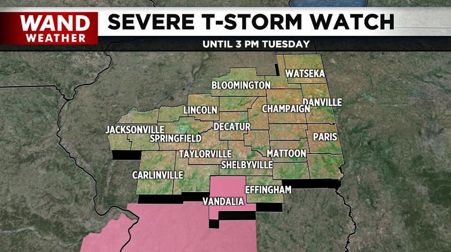
Fayette County was added to a "Severe Thunderstorm Watch" until 3 p.m. Tuesday for those storms.
A cold front will move through this afternoon. Western hometowns have already dropped from the 70s to the low-60s behind the front by midday.
After a quiet night, more showers arrive Wednesday morning with a few storms in the afternoon. Some of the storms could be on the stronger side. This will continue into Thursday.


