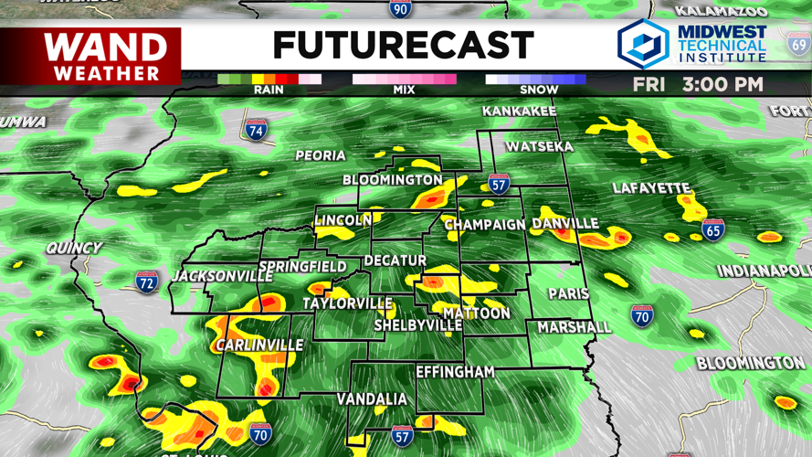


DECATUR, IL. (WAND) - Happy Friday! Showers and storms will be in the area throughout the entire day. There have already been a few light rounds of showers this morning. Shower and storm chances will increase throughout the afternoon. Expect steady to heavy rainfall this evening. Severe weather threats are low, but some of the storms could produce very strong winds and hail. The main concern will be flooding issues. High water is possible with another 2 to 3 inches of rain possible throughout the day.
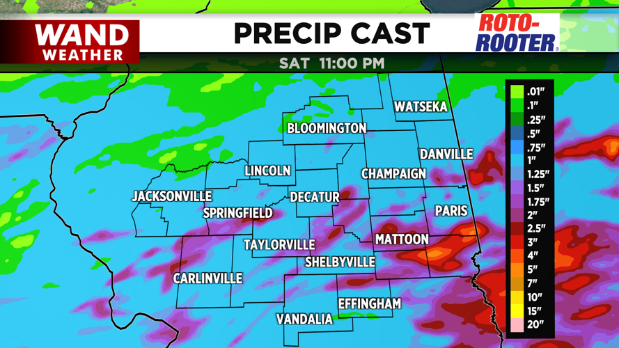
Showers should exit overnight, and Saturday is looking mostly dry. Temperatures on Saturday will stay slightly below average in the low 80s, but this will be the last mild day for a while. Rain chances will return overnight into early Sunday morning. These showers should exit early on Sunday morning, but they will leave the area hot and muggy. Temperatures will soar into the low 90s by Sunday afternoon.
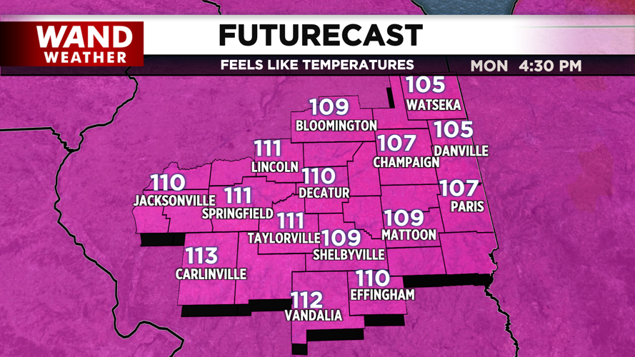
Next week is looking hot and humid. Feels-like temperatures are expected to be around 105-110 by next Tuesday and Wednesday. This could be the criteria for heat advisories, so be prepared for the hottest stretch of weather so far this year.
Have a great weekend!
Copyright 2026. WANDTV. All Rights Reserved.


