


Expect rounds of showers and storms across Central Illinois for the holiday weekend. A cold front passed through the region during the overnight which will bring temperatures down to at or near 60°; under cloudy skies.
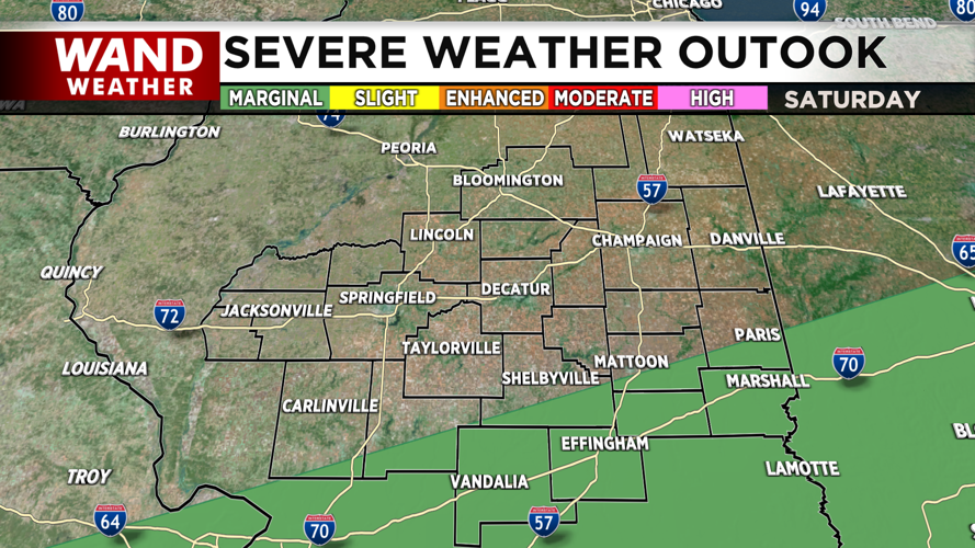
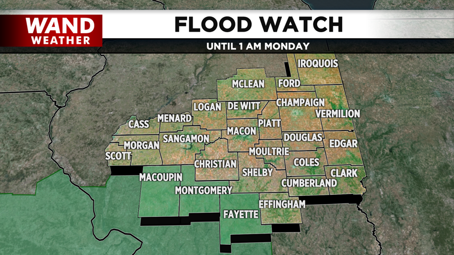
The best chance of heavy rain along with strong to severe storms will be along or south of I-70. The biggest threats of today's stronger storms will be wind and hail. A Flood Watch is in effect for Macoupin, Montgomery and Fayette Counties until late Sunday night.
Easter Sunday will be milder, with highs in the low 70s and breezy winds out of the southeast late in the day. Showers are expected for the morning hours with a break in the activity in the afternoon. This lull could include some sunshine which would help fuel the potential for storms in the evening.
The storms are expected to pass through Central Illinois on Sunday night. Western areas are under a Slight (Level 2) risk, while eastern portions are within a Marginal (Level 1) risk. Wind and hail are the main concerns but an isolated tornado is also possible towards the west of I-55. The clouds are expected to linger on Monday, under breezy conditions and seasonable temperatures in the mid 60s.
Copyright 2025. WAND TV. All right reserved.


