
DECATUR, Ill. (WAND) - Severe storms that struck parts of the area are shifting off to the north and east. Unfortunately, the spotty coverage and lack of widespread rain will allow the terrible drought to continue.
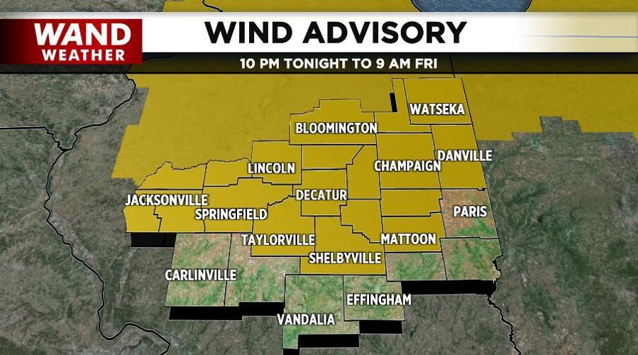
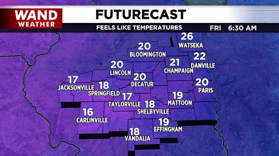
Hit/miss heavy thunderstorms will give way to winter as the night progresses. Non-thunderstorm wind gusts will eclipse 30 mph on a regular basis overnight, and tip the scales in the 40-50 mph range on occasion into Friday morning. This all occurs on the backside of our exiting storm system. A shift in the source region for our air will usher feelslike temperatures in the teens and 20s back across the region to start off Friday. A few flurries may even skirt areas north of I-74 early Friday. It won't get much better in the afternoon, so dress appropriately.
Stay warm and stay weather aware.
Copyright 2026. WANDTV. All Rights Reserved.


